
Showing all 12 results
-

1775
Carte Reduite de L’Ocean Oriental Depuis le Cap de Bonne Esperance, Jusqu’au Japon.
$A 3,250 Add to cart -
")
1809
Carte Reduite de L’Ocean Oriental, depuis Le Cap de Bonne Esperance Jusqu’a L’Isle Formose, Dediee au Roi
$A 1,250 Add to cart -

1862
Der Atlantische Ocean
$A 125 Add to cart -
")
1889
Tiefenkarte des Indischen Oceans
$A 75 Add to cart -
")
1890
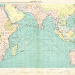
India, and its connection with Egypt and the Mediterranean
$A 75 Add to cart -

1890
Chart of the North Atlantic Ocean on Mercators Projection. Showing connection between the British Isles and colonies in America
$A 55 Add to cart -

1902
Commercial Chart of North Atlantic.
$A 145 Add to cart -

1920
The North Atlantic Ocean.
$A 175 Add to cart -

1920
The South Atlantic Ocean
$A 175 Add to cart -
")
1920
The Western Mediterranean
$A 245 Add to cart -
")
1920
The Eastern Mediterranean
$A 195 Add to cart -
![[MEDITERRANEAN] Mediterranean and Black Seas](https://antiqueprintmaproom.com/wp-content/uploads/2022/09/MG_6392-copy-270x149.jpg "[MEDITERRANEAN] Mediterranean and Black Seas MIDDLE EAST")
1921
[MEDITERRANEAN] Mediterranean and Black Seas
$A 950 Add to cart
Showing all 12 results
