


Showing 193–240 of 444 results
-

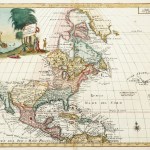
1834
Upper Canada. &c. By J. Arrowsmith.
$A 1,250 Add to cart -

1834
Peru & Bolivia, by J. Arrowsmith.
$A 375 Add to cart -

1834
North America Index Map to Canada and the United States
$A 175 Add to cart -

1834
North America XIV Florida
$A 425 Add to cart -

1834
United States, by J. Arrowsmith.
$A 950 Add to cart -

1835
The British Islands in the West Indies
$A 155 Add to cart -

1835
The Antilles or West-Indian Islands
$A 195 Add to cart -
")
1835
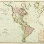
America, by J. Arrowsmith.
$A 950 Add to cart -

1837
South America Sheet III South Brazil with Paraguay and Uruguay
$A 85 Add to cart -

1838
West Indies
$A 65 Add to cart -

1838
Amerique Meridionale.
$A 375 Add to cart -

1838
South America Sheet V. Patagonia
$A 85 Add to cart -

1840
South America Sheet VI Bolivia and Peru
$A 65 Add to cart -

1840
South America, Guayana and North Brazil
$A 30 Add to cart -
![[SOUTH AMERICA-ARGENTINA] Staten Island by Lieuten. Rendell 1828](https://antiqueprintmaproom.com/wp-content/uploads/2023/11/MG_8935-Web-270x204.jpg "[SOUTH AMERICA-ARGENTINA] Staten Island by Lieuten. Rendell 1828 Americas")
1840
[SOUTH AMERICA-ARGENTINA] Staten Island by Lieuten. Rendell 1828
$A 1,650 Add to cart -

1840
South America Sheet IV La Plata and Chile
$A 65 Add to cart -

1840
Rio de Janeiro.
$A 110 Add to cart -
![[SOUTH AMERICA] South America West Coast Sheet XII Peru Cape Lobos to Pescadores Point by Capt. Robert Fitz Roy R.N. and the Officers of H.M.S. Beagle 1836](https://antiqueprintmaproom.com/wp-content/uploads/2024/12/MG_9378web-270x209.jpg "[SOUTH AMERICA] South America West Coast Sheet XII Peru Cape Lobos to Pescadores Point by Capt. Robert Fitz Roy R.N. and the Officers of H.M.S. Beagle 1836 Americas")
1840
[SOUTH AMERICA] South America West Coast Sheet XII Peru Cape Lobos to Pescadores Point by Capt. Robert Fitz Roy R.N. and the Officers of H.M.S. Beagle 1836
$A 1,250 Add to cart -
![[SOUTH AMERICA] The South-Eastern Part of Tierra del Fuego with Staten Island, Caper Horn and Diego Ramirez Islands.](https://antiqueprintmaproom.com/wp-content/uploads/2023/11/MG_8767-Web-270x182.jpg "[SOUTH AMERICA] The South-Eastern Part of Tierra del Fuego with Staten Island, Caper Horn and Diego Ramirez Islands. Americas")
1841
[SOUTH AMERICA] The South-Eastern Part of Tierra del Fuego with Staten Island, Caper Horn and Diego Ramirez Islands.
$A 650 Add to cart -

1842
Central America I. Including Yucatan, Belize, Guatemala, Salvador, Honduras, Nicaragua and the southern states of Mexico.
$A 85 Add to cart -

1843
Canada
$A 575 Add to cart -

1843
United States and Texas.
$A 1,250 Add to cart -

1843
West Indian Islands
$A 575 Add to cart -
![[Americas] No.2](https://antiqueprintmaproom.com/wp-content/uploads/2020/07/usa_sduk_008-261x270.jpg "[Americas] No.2 United States")
1844
[Americas] No.2
$A 75 Add to cart -

1847
Harbour of Annis Squam in Ipswich Bay.
$A 65 Add to cart -

1847
Pensacola Harbour
$A 110 Add to cart -

1848
SOUTH AMERICA-Bett’s Family Atlas Northern Part of South America.
$A 195 Add to cart -

1849
Physikalische Karte von Sudamerika
$A 40 Add to cart -

1850
Boston with Charlestown and Roxbury.
$A 395 Add to cart -

1850
Map of the Orinoco Exhibiting its Bifurcation and its Connexion with the River Amazon ….
$A 75 Add to cart -

1850
Philadelphia.
$A 245 Add to cart -

1850
The Mountain Chains of America.
$A 55 Add to cart -

1851
Portland Harbour.
$A 110 Add to cart -

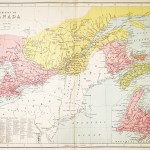
1851
Canada
$A 195 Add to cart -

1851
Delaware Bay.
$A 245 Add to cart -
![Isles of Shoals. [Hog Island]](https://antiqueprintmaproom.com/wp-content/uploads/2020/06/img_20200316_130951_-226x270.jpg "Isles of Shoals. [Hog Island] United States")
1851
Isles of Shoals. [Hog Island]
$A 55 Add to cart -
![[Sapello Island, Cabarita Island, Doboy Sound, Pelican Shoals]](https://antiqueprintmaproom.com/wp-content/uploads/2020/06/usa_ga_1851_blun_12-270x215.jpg "[Sapello Island, Cabarita Island, Doboy Sound, Pelican Shoals] United States")
1851
[Sapello Island, Cabarita Island, Doboy Sound, Pelican Shoals]
$A 225 Add to cart -

1851
Tybee Bay, and Savannah River.
$A 165 Add to cart -

1851
Entrance to the Chesapeake Bay.
$A 195 Add to cart -
![[Gloucester Harbor] Cape Ann Harbour.](https://antiqueprintmaproom.com/wp-content/uploads/2020/06/usa_ma_1851_blun_13-232x270.jpg "[Gloucester Harbor] Cape Ann Harbour. Town Plans")
1851
[Gloucester Harbor] Cape Ann Harbour.
$A 175 Add to cart -
![[SOUTH AMERICA] Magellan Strait Barbara Channel Surveyed by Capt. P.P. King R.N. 1829](https://antiqueprintmaproom.com/wp-content/uploads/2023/09/MG_8484-web-185x270.jpg "[SOUTH AMERICA] Magellan Strait Barbara Channel Surveyed by Capt. P.P. King R.N. 1829 South America")
1852
[SOUTH AMERICA] Magellan Strait Barbara Channel Surveyed by Capt. P.P. King R.N. 1829
$A 1,500 Add to cart -

1854
Venezuela, New Granada, Equador and The Guayanas
$A 195 Add to cart -

1854
Central America
$A 245 Add to cart -

1854
Falkland Islands and Patagonia
$A 325 Add to cart -

1854
British Guayana
$A 175 Add to cart -

1854
East Canada and New Brunswick
$A 295 Add to cart -

1854
Isthmus of Panama
$A 325 Add to cart -

1855
The City of St.Louis Missouri. The City of Chicago Illinois.
$A 145 Add to cart
Showing 193–240 of 444 results