Showing all 21 results
-

1704
A New Map of Great Tartary, and China, taken from the adjoining Parts of Asia, taken from Mr. de Fers Map of Asia.
$A 650 Add to cart -
![Asia Corrected from the Observations communicated to the Royal Society at London and the Royal Academy at Paris. By John Senex F.R.S. To The Honorable Sr. George Markham. Baronet. This Map is Dedicated by his humble Obedient Serv[an]t John Senex.](https://antiqueprintmaproom.com/wp-content/uploads/2020/06/MG_9190-Web-270x188.jpg "Asia Corrected from the Observations communicated to the Royal Society at London and the Royal Academy at Paris. By John Senex F.R.S. To The Honorable Sr. George Markham. Baronet. This Map is Dedicated by his humble Obedient Serv[an]t John Senex. China")
1709
Asia Corrected from the Observations communicated to the Royal Society at London and the Royal Academy at Paris. By John Senex F.R.S. To The Honorable Sr. George Markham. Baronet. This Map is Dedicated by his humble Obedient Serv[an]t John Senex.
$A 2,450 Add to cart -

1747
A New & Exact Map of Asia Compiled from Surveys & Authentick Journals….
$A 575 Add to cart -

1748
Bosporus, Maeotis, Iberia, Albania, and Asiatic Sarmatia
$A 155 Add to cart -

1751
Premiere Partie de la Carte D’Asie Contenant la Turquie, L’Arabie, la Perse, L’Inde en Deca du Gange….
$A 1,450 Add to cart -
![[Caspian Sea] Essaie d'une Nouvelle Carte de la Mer Caspienne](https://antiqueprintmaproom.com/wp-content/uploads/2020/06/MG_1264-copy-144x270.jpg "[Caspian Sea] Essaie d’une Nouvelle Carte de la Mer Caspienne MAPS & GLOBES")
1756
[Caspian Sea] Essaie d’une Nouvelle Carte de la Mer Caspienne
$A 325 Add to cart -

1764
Carte de la Tartarie Occidentale
$A 145 Add to cart -

1764
Carte de la Tartarie Chinoise, avec la partie limtrophe de la Siberie.
$A 165 Add to cart -

1774
Carte de la Tartarie Independante..
$A 225 Add to cart -

1774
Royaumede Perse
$A 145 Add to cart -

1781
Carte de la Tartarie Independante qui comprend le Pays des Calmuks, celui des Usbeks, et le Turkestan….Projettee et assujiettie aux observations Astronomiques per M.Bonne…1771
$A 245 Add to cart -

1830
Asia Minor
$A 65 Add to cart -

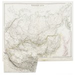
1834
Northern Asia from the Himalaya Mountains to the Arctic Ocean.
$A 245 Add to cart -

1870
Sketch map of Eastern Turkistan showing the hydrography of the Pamir to the East; the true courses of the Yarkand and Karakash rivers with all the routes from Ladak across the Karakoram and adjacent ranges,
$A 125 Add to cart -

1876
Sketch Map of Eastern Turkistan..
$A 45 Add to cart -

1882
The Chinese Empire. and Japan
$A 145 Add to cart -

1888
The Hydrography of South Eastern Tibet.
$A 145 Add to cart -

1888
Central Asia From Peking to Yarkand and Kashmir via the Mustagh Pass …
$A 145 Add to cart -

1889
Ubersichtskarte von General N.M. Prezewalsskkij’s Reisen in Central-Asien 1871-73, 1876, 77,-1879, 80,-u.1884, 85.
$A 110 Add to cart -

1902
Northern Asia. Central Asia.
$A 95 Add to cart -

1905
Map of the War in the Far East
$A 475 Add to cart
Showing all 21 results