


Showing 673–720 of 1014 results
-
![[NT SET 8 MAPS] Geological Sketch Map no. 1 to 8](https://antiqueprintmaproom.com/wp-content/uploads/2023/11/Untitled-1-copy-270x228.jpg "[NT SET 8 MAPS] Geological Sketch Map no. 1 to 8 AUSTRALIA")
1895
[NT SET 8 MAPS] Geological Sketch Map no. 1 to 8
$A 650 Add to cart -
")
1895
Volkerkarte von Ozeanien und Australasien.
$A 125 Add to cart -
")
1895
Australien.
$A 145 Add to cart -

1895
Water-Supply-Department. Map of Queensland showing Annual Rainfall to end of 1895
$A 525 Add to cart -
")
1895
Australien.
$A 145 Add to cart -

1896
Western Australia Northern Section
$A 225 Add to cart -

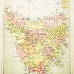
1896
Tasmania
$A 195 Add to cart -

1896
Parliamentary Plan and Section of Proposed Duplicate Line of Tramway from South-Terrace, Adelaide, to Fullarton Tram Sheds, for the Parkside Tramway Company, Limited.
$A 325 Add to cart -
 South Australia")
1896
Plan of Legislative Council Electoral Districts Exclusive of District No.27 (The Northern Territory)
$A 750 Add to cart -

1896
South Australia
$A 95 Add to cart -

1896
Plan Shewing Pastoral Leases and Claims in the Northern Territory of South Australia ….
$A 1,450 Add to cart -

1896
Railway Map of West Australian Southern Section.
$A 175 Add to cart -
![[AUSTRALIA-WA] C.Mentelle to White Pt. shewing approaches to Cape Leeuwin and Flinders Bay Surveyed by Staff Commander W.E.Archdeacon,R.N.](https://antiqueprintmaproom.com/wp-content/uploads/2020/06/mg_7593_copy_1_1-270x186.jpg "[AUSTRALIA-WA] C.Mentelle to White Pt. shewing approaches to Cape Leeuwin and Flinders Bay Surveyed by Staff Commander W.E.Archdeacon,R.N. Western Australia")
1896
[AUSTRALIA-WA] C.Mentelle to White Pt. shewing approaches to Cape Leeuwin and Flinders Bay Surveyed by Staff Commander W.E.Archdeacon,R.N.
$A 1,250 Add to cart -

1897
South Australia
$A 65 Add to cart -
![[AUSTRALIA-WA] Esperance Bay Anchorage](https://antiqueprintmaproom.com/wp-content/uploads/2020/06/mg_8017_copy_1_2-270x205.jpg "[AUSTRALIA-WA] Esperance Bay Anchorage Town Plans")
1897
[AUSTRALIA-WA] Esperance Bay Anchorage
$A 850 Add to cart -
![[Ballina to Evans Head]](https://antiqueprintmaproom.com/wp-content/uploads/2023/08/MG_8121copy-a-204x270.jpg "[Ballina to Evans Head] New South Wales")
1897
[Ballina to Evans Head]
$A 425 Add to cart -
![[Ten Mile Beach, N.S.W.]](https://antiqueprintmaproom.com/wp-content/uploads/2023/08/MG_9299-Web-270x205.jpg "[Ten Mile Beach, N.S.W.] New South Wales")
1897
[Ten Mile Beach, N.S.W.]
$A 145 Add to cart -

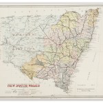
1897
Map of New South Wales 1897
$A 1,250 Add to cart -
![[AUSTRALIA-WA] Esperance Bay Anchorage / Mary Ann Haven (Hopetoun Harbour)](https://antiqueprintmaproom.com/wp-content/uploads/2021/03/MG_2513-copy-270x201.jpg "[AUSTRALIA-WA] Esperance Bay Anchorage / Mary Ann Haven (Hopetoun Harbour) Western Australia")
1897
[AUSTRALIA-WA] Esperance Bay Anchorage / Mary Ann Haven (Hopetoun Harbour)
$A 850 Add to cart -
![[AUSTRALIA-WA] Esperance Bay and Approaches Surveyed by Commander J.W. Combe. Assisted by Lieutenants F.C.C. Pasco, G.E. Corbett, W.T.P. Wilson & Sub-Lieut, B.O.M. Davy.](https://antiqueprintmaproom.com/wp-content/uploads/2021/03/MG_2548-copy-270x181.jpg "[AUSTRALIA-WA] Esperance Bay and Approaches Surveyed by Commander J.W. Combe. Assisted by Lieutenants F.C.C. Pasco, G.E. Corbett, W.T.P. Wilson & Sub-Lieut, B.O.M. Davy. Western Australia")
1897
[AUSTRALIA-WA] Esperance Bay and Approaches Surveyed by Commander J.W. Combe. Assisted by Lieutenants F.C.C. Pasco, G.E. Corbett, W.T.P. Wilson & Sub-Lieut, B.O.M. Davy.
$A 850 Add to cart -

1898
Abel Janszoon Tasman’s Journal of His Discovery of Van Diemens Land and New Zealand in 1642 with Documents Relating to His Exploration of Australia in 1644.
$A 4,750 Add to cart -

1898
Proposed Old Koomooloo Vermin District
$A 450 Add to cart -
![[AUSTRALIA-WA] Plans on the south West Coast of Australia / Koombanah Bay / Hamelin Bay / Hamelin Inner Harbour](https://antiqueprintmaproom.com/wp-content/uploads/2021/03/MG_2511-copy-1-201x270.jpg "[AUSTRALIA-WA] Plans on the south West Coast of Australia / Koombanah Bay / Hamelin Bay / Hamelin Inner Harbour Western Australia")
1898
[AUSTRALIA-WA] Plans on the south West Coast of Australia / Koombanah Bay / Hamelin Bay / Hamelin Inner Harbour
$A 550 Add to cart -

1898
New South Wales. Victoria.
$A 145 Add to cart -
")
1898
Oceania
$A 195 Add to cart -
![[AUSTRALIA-QLD] Double Pt. to Cape Grafton](https://antiqueprintmaproom.com/wp-content/uploads/2022/05/MG_5907-copy-185x270.jpg "[AUSTRALIA-QLD] Double Pt. to Cape Grafton Queensland")
1899
[AUSTRALIA-QLD] Double Pt. to Cape Grafton
$A 850 Add to cart -

1899
Plan of Stock Route Hughenden to Cloncurry Queensland 1899
$A 675 Add to cart -

1899
Queensland 1899 / Areas Surveyed and Mapped Out During 1898,……
$A 325 Add to cart -

1899
Geological Sketch Map With Sections. Showing deposits of Bauxite and Aluminous Iron Ore Wingello.
$A 125 Add to cart -

1899
Sketch Map Shewing Rabbit Board Districts and Rabbit Proof Fences Queensland.
$A 850 Add to cart -

1900
Drainage Area of the Murray River
$A 375 Add to cart -

1900
Proposed Alteration of Boundary of Elliston Vermin District.
$A 450 Add to cart -

1900
Twofold Bay
$A 275 Add to cart -
![Sketch map showing proposed Federal Territory and capital site at Bombala [cartographic material] : Parishes of Bombala, Gecar, Ashton, Maharatta, Mila, Hayden, Gulgin, Delegete, Pickering, Burnima and Burrimbucco, County of Wellesley, New South Wales 190](https://antiqueprintmaproom.com/wp-content/uploads/2020/04/pp_sftsog_fed_003-270x225.jpg "Sketch map showing proposed Federal Territory and capital site at Bombala [cartographic material] : Parishes of Bombala, Gecar, Ashton, Maharatta, Mila, Hayden, Gulgin, Delegete, Pickering, Burnima and Burrimbucco, County of Wellesley, New South Wales 190 Australian Capital Territory")
1900
Sketch map showing proposed Federal Territory and capital site at Bombala [cartographic material] : Parishes of Bombala, Gecar, Ashton, Maharatta, Mila, Hayden, Gulgin, Delegete, Pickering, Burnima and Burrimbucco, County of Wellesley, New South Wales 190
$A 650 Add to cart -

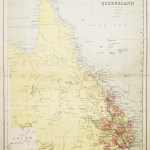
1900
Map of Queensland
$A 525 Add to cart -

1900
Sketch map showing proposed Federal Territory and capital site at Carcoar Parishes of Lyndhurst, Belubula, Somers, Hampton, Waugoola, Lucan, Shaw & Errol, County of Bathurst N.S.W. 1900
$A 650 Add to cart -

1900
Town Lots Auction Sale Crown Lands Port Hacking on Tuesday 10th.. April 1900 at 11-30 o’clock a.m. Plan of the Village of Gunn Amatta Parish of Sutherland County of Cumberland Land District Liverpool…
$A 1,150 Add to cart -

1900
Sketch map showing proposed Federal Territory and capital site at Wellington Parishes of Nanima, Wuuluman, Yarragal, County of Bligh Parishes of Curra, Gundy, Ponto, County of Gordon Parishes of Mickety Mulga, Bodangora, County of Lincoln Parishes of Galw
$A 550 Add to cart -

1900
Australia and Tasmania
$A 225 Add to cart -
![[AUSTRALIA-WA] Mary Anne Passage and Approaches Surveyed by Commander J.W. Combe, R.N.](https://antiqueprintmaproom.com/wp-content/uploads/2021/03/MG_2533-copy-185x270.jpg "[AUSTRALIA-WA] Mary Anne Passage and Approaches Surveyed by Commander J.W. Combe, R.N. Western Australia")
1901
[AUSTRALIA-WA] Mary Anne Passage and Approaches Surveyed by Commander J.W. Combe, R.N.
$A 950 Add to cart -

1901
Water Supply Department – Map of Queensland Showing Positions, Depths, Flows, &c. of Artesian Borings 1901
$A 575 Add to cart -
 Western Australia")
1902
Australien (Commonwealth of Australia)
$A 325 Add to cart -

1902
Map of the Public Parks and Recreation Reserves within the City of Sydney & Environs.
$A 650 Add to cart -

1902
Sketch Map of New South Wales Shewing Rabbit-Proof Fences.
$A 850 Add to cart -

1902
N.S.W.C.T. Oxford Street to Bellevue Hill Electric Tramway
$A 850 Add to cart -
![[AUSTRALIA-WA] Cape Le Grand to Cape Pasley with part of the Archipelago of the Recherche surveyed by Commander J.W.Combe. R.N.](https://antiqueprintmaproom.com/wp-content/uploads/2020/06/mg_7581_copy_1-270x186.jpg "[AUSTRALIA-WA] Cape Le Grand to Cape Pasley with part of the Archipelago of the Recherche surveyed by Commander J.W.Combe. R.N. Western Australia")
1902
[AUSTRALIA-WA] Cape Le Grand to Cape Pasley with part of the Archipelago of the Recherche surveyed by Commander J.W.Combe. R.N.
$A 750 Add to cart -

1902
Sketch Map Shewing Progress of Triangulation in N.S.W. 1901.
$A 525 Add to cart -
![[AUSTRALIA-VIC] Port Phillip to Gabo Island Compiled from the Latest Admiralty Surveys](https://antiqueprintmaproom.com/wp-content/uploads/2020/06/mg_7587_copy_1-270x184.jpg "[AUSTRALIA-VIC] Port Phillip to Gabo Island Compiled from the Latest Admiralty Surveys New South Wales")
1902
[AUSTRALIA-VIC] Port Phillip to Gabo Island Compiled from the Latest Admiralty Surveys
$A 650 Add to cart
Showing 673–720 of 1014 results