Showing 385–432 of 889 results
-

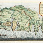
1832
South Italy by J. Arrowsmith.
$A 650 Add to cart -
 Scandinavia")
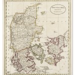
1833
Denmark and part of Norway (Denmark, Norge)
$A 85 Add to cart -

1833
The Southern Provinces of Sweden
$A 110 Add to cart -

1834
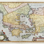
Thrace Moesie et Dacie
$A 75 Add to cart -
")
1834
Europe Vers l’An 370
$A 90 Add to cart -

1834
Pays-Bas
$A 35 Add to cart -

1834
The Northern Provinces of Sweden and Norway with Part I, of Russia.
$A 90 Add to cart -

1834
Russie d’Europe
$A 40 Add to cart -

1834
North Italy &c.
$A 650 Add to cart -

1834
France by J. Arrowsmith.
$A 325 Add to cart -

1834
Russia in Europe Part III
$A 75 Add to cart -

1834
Russia & Poland.
$A 475 Add to cart -

1834
France divisee en Provinces
$A 35 Add to cart -

1834
Colchide Iberie et Albanie
$A 85 Add to cart -

1834
Espagne Ancienne
$A 110 Add to cart -

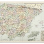
1834
Espagne et Portugal
$A 110 Add to cart -

1834
Grece Ancienne Partie Meridionale
$A 90 Add to cart -
")
1834
Europe apres l’invasion Des Barbares
$A 90 Add to cart -

1834
Turkey in Asia, by J. Arrowsmith.
$A 325 Add to cart -

1834
Presqu’ile de L’Asie Occidentale ou Asie Mineure
$A 90 Add to cart -
")
1834
Europe sous Charlemagne
$A 85 Add to cart -

1834
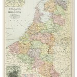
Holland & Belgium by J. Arrowsmith.
$A 425 Add to cart -

1835
Russia in Europe Part V.
$A 50 Add to cart -

1835
Gallia Antiqua.
$A 45 Add to cart -

1835
Russia in Europe Part VII.
$A 50 Add to cart -

1835
Russia in Europe Part IX and Georgia
$A 65 Add to cart -

1835
Germania, Vindelicia, Rhaetia, et Noricum.
$A 60 Add to cart -

1835
Russia in Europe Part II.
$A 65 Add to cart -

1835
Russia in Europe Part IV.
$A 50 Add to cart -

1835
Dacia, Moesia, Pannonia et Illyricum.
$A 60 Add to cart -

1835
Hispania.
$A 45 Add to cart -

1835
Sarmatia.
$A 75 Add to cart -

1835
Russia in Europe Part VI.
$A 50 Add to cart -

1835
Insulae Aegaei Maris.
$A 145 Add to cart -

1835
Italiae pars Borealis sive Gallia Cisalpina.
$A 50 Add to cart -

1835
Russia in Europe Part VIII
$A 50 Add to cart -

1835
Italia Media.
$A 115 Add to cart -

1835
Italiae Meridionalis pars et Sicilia
$A 125 Add to cart -

1836
Kingdoms of Holland & Belgium
$A 65 Add to cart -

1838
Russie D’Europe
$A 20 Add to cart -
")
1838
Empire de Charlemagne
$A 45 Add to cart -

1838
Holland and Belgium
$A 65 Add to cart -

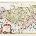
1838
Siberie ou Russie D’Asie
$A 25 Add to cart -

1838
Western Siberia, Independent Tartary, Khiva, Bokhara &c
$A 75 Add to cart -
")
1838
Europe.
$A 30 Add to cart -

1838
Hollande et Belgique
$A 45 Add to cart -

1838
Allemagne ou Confederation Germanique
$A 45 Add to cart -

1838
Prusse
$A 40 Add to cart
Showing 385–432 of 889 results