


Showing 193–240 of 724 results
-

1856
Zoological geography. Geographical division and distribution of Reptilia, reptiles
$A 325 Add to cart -

1856
Meteors. Track of Meteors Observed at the Royal Observatory Greenwich November 13. 14. 1866
$A 195 Add to cart -

1856
Edinburgh & Leith
$A 85 Add to cart -

1856
Map of the distribution of marine life, illustrated chiefly by fishes, Molluscs & Radiata; showing also the extent & limits of the Homoiozoic belts, now first laid down for Keith Johnston’s Physical atlas by Professor Edward Forbes
$A 195 Add to cart -

1856
Tidal Chart of the British Seas. Showing the Progress of the Wave of High Water, the Hour of High Water in Greenwich Time at New and Full Moon; and the Depth of the Sea.
$A 145 Add to cart -

1856
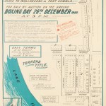
Town and Suburban Lands at Gisborne in the County of Bourke
$A 1,250 Add to cart -

1857
Village of Osborne, Mt Martha County, of Mornington.
$A 850 Add to cart -
![[NEW ZEALAND] Manukau Harbour to Cape Egmont Surveyed by Comr. B. Drury and the Officers of H.M.S. Pandora. ...](https://antiqueprintmaproom.com/wp-content/uploads/2022/10/MG_6567-copy-182x270.jpg "[NEW ZEALAND] Manukau Harbour to Cape Egmont Surveyed by Comr. B. Drury and the Officers of H.M.S. Pandora. … New Zealand")
1857
[NEW ZEALAND] Manukau Harbour to Cape Egmont Surveyed by Comr. B. Drury and the Officers of H.M.S. Pandora. …
$A 2,450 Add to cart -

1857
[NEW ZEALAND Foveaux Strait and South Id.
$A 1,450 Add to cart -
![[NEW ZEALAND] R. Awarua to Abut Head from a Running Survey by Captn. J.L. Stokes...](https://antiqueprintmaproom.com/wp-content/uploads/2021/03/MG_5912-copy-270x215.jpg "[NEW ZEALAND] R. Awarua to Abut Head from a Running Survey by Captn. J.L. Stokes… New Zealand")
1857
[NEW ZEALAND] R. Awarua to Abut Head from a Running Survey by Captn. J.L. Stokes…
$A 325 Add to cart -
 of Port Jackson. Town Plans")
1857
Plan of Garden Island (The Naval Depot) of Port Jackson.
$A 1,250 Add to cart -

1858
Fluss Und Bergkarte Von Deutschland Und Den Anliegenden Landern
$A 55 Add to cart -
![[NEW ZEALAND] Abut Head to Cape Foulwind](https://antiqueprintmaproom.com/wp-content/uploads/2020/06/mg_8462_copy_1-181x270.jpg "[NEW ZEALAND] Abut Head to Cape Foulwind New Zealand")
1858
[NEW ZEALAND] Abut Head to Cape Foulwind
$A 1,350 Add to cart -
![[SOUTH AMERICA-BRAZIL] THE ROCAS by Lieut. A.Vital de Oliveira, Impl. Brazilian Navy.](https://antiqueprintmaproom.com/wp-content/uploads/2020/09/MG_1391-copy-270x179.jpg "[SOUTH AMERICA-BRAZIL] THE ROCAS by Lieut. A.Vital de Oliveira, Impl. Brazilian Navy. Americas")
1858
[SOUTH AMERICA-BRAZIL] THE ROCAS by Lieut. A.Vital de Oliveira, Impl. Brazilian Navy.
$A 275 Add to cart -

1858
Plan of the Harbour of Newcastle. Shewing the Proposed Extension of the Northern Pier.
$A 2,250 Add to cart -

1858
Township & Suburban Allotments of Dandenong Parishes of Dandenong and Eumennerring Counties of Bourke and Mornington.
$A 850 Add to cart -
![[NEW ZEALAND] Cook Strait Anchorages. Sheet 2. Croisilles Harbour, Pelorus Sound, Port Gore, Queen Charlotte Sound, Tory Channel, & Port Underwood.](https://antiqueprintmaproom.com/wp-content/uploads/2022/05/MG_5904-copy-270x183.jpg "[NEW ZEALAND] Cook Strait Anchorages. Sheet 2. Croisilles Harbour, Pelorus Sound, Port Gore, Queen Charlotte Sound, Tory Channel, & Port Underwood. New Zealand")
1859
[NEW ZEALAND] Cook Strait Anchorages. Sheet 2. Croisilles Harbour, Pelorus Sound, Port Gore, Queen Charlotte Sound, Tory Channel, & Port Underwood.
$A 1,250 Add to cart -

1859
Der Nordliche Stern.Himmel..
$A 195 Add to cart -
![[NEW ZEALAND] Cook Strait Anchorages. Sheet 1. Durville Island](https://antiqueprintmaproom.com/wp-content/uploads/2020/06/mg_8473_copy_2-270x185.jpg "[NEW ZEALAND] Cook Strait Anchorages. Sheet 1. Durville Island New Zealand")
1859
[NEW ZEALAND] Cook Strait Anchorages. Sheet 1. Durville Island
$A 1,750 Add to cart -
 (Genes) Town Plans")
1859
Genoa (Genova) (Genes)
$A 195 Add to cart -

1859
Toulon (ancient Telo Matius.
$A 145 Add to cart -

1859
Plan of the Valley of Bendigo
$A 750 Add to cart -

1859
Chart of Isothermal Lines, Shewing the Mean Annual Temperature of the Different Parts of the Earth’s Surface.
$A 65 Add to cart -

1859
The Environs of Edinburgh
$A 195 Add to cart -

1860
The Township of Sandridge.
$A 2,750 Add to cart -

1860
Chambers’s for the Atlas People with Descriptive Introduction.
$A 275 Add to cart -

1860
Plan of Ship Canal & Site for Docks.
$A 750 Add to cart -

1860
Tableau des Recions Circumpolaires ou Carte Spheroidale des deux Poles.
$A 575 Add to cart -

1860
Tableau general des courants atmospheriques et oceaniques, ou resume des observations meteorologiques ….
$A 450 Add to cart -

1861
Plan shewing Extent and present Boundaries of the Outer Domain.
$A 750 Add to cart -

1862
Philips’ Map of London for Visitors to the Internation Exhibition 1862.
$A 575 Add to cart -

1862
Westliche Halbrugel
$A 195 Add to cart -

1862
Portion of Corner Inlet Shewing the Entrance to Welshpool Surveyed by Commander Ross, 1855.
$A 1,250 Add to cart -

1862
Der Atlantische Ocean
$A 125 Add to cart -
![[PACIFIC-NEW CALEDONIA] Kunie or Isle of Pines to Wen Island.](https://antiqueprintmaproom.com/wp-content/uploads/2020/06/img_4813_copy_1-183x270.jpg "[PACIFIC-NEW CALEDONIA] Kunie or Isle of Pines to Wen Island. Melanesia")
1863
[PACIFIC-NEW CALEDONIA] Kunie or Isle of Pines to Wen Island.
$A 475 Add to cart -

1863
Oestliche Halbkugel
$A 225 Add to cart -

1863
Suburbs of London Sheet 3. Bromley, Blackwall &c.
$A 450 Add to cart -

1863
Suburbs of London Sheet 1. Bayswater, Notting Hill, Kensal Green, Shepherds Bush &c.
$A 450 Add to cart -
![[AUSTRALIA-QLD] Keppel Islands to Percy Isles Excluding Capricorn Channel.](https://antiqueprintmaproom.com/wp-content/uploads/2020/06/keppel-isles-270x121.jpg "[AUSTRALIA-QLD] Keppel Islands to Percy Isles Excluding Capricorn Channel. Queensland")
1863
[AUSTRALIA-QLD] Keppel Islands to Percy Isles Excluding Capricorn Channel.
$A 650 Add to cart -
![[AFRICA-EGYPT] Mersa Matruh to Alexandria](https://antiqueprintmaproom.com/wp-content/uploads/2024/05/MG_9698web-270x152.jpg "[AFRICA-EGYPT] Mersa Matruh to Alexandria Africa Countries")
1864
[AFRICA-EGYPT] Mersa Matruh to Alexandria
$A 450 Add to cart -
![[AFRICA-EYGPT] Derna to Mersa MAtruh](https://antiqueprintmaproom.com/wp-content/uploads/2024/05/MG_9704web-270x184.jpg "[AFRICA-EYGPT] Derna to Mersa MAtruh Africa Countries")
1864
[AFRICA-EYGPT] Derna to Mersa MAtruh
$A 300 Add to cart -
![[AUSTRALIA-SA] Wood Point to Lowly Point Including the Approach to Port Augusta.......](https://antiqueprintmaproom.com/wp-content/uploads/2022/04/MG_5641-copy-270x188.jpg "[AUSTRALIA-SA] Wood Point to Lowly Point Including the Approach to Port Augusta……. South Australia")
1865
[AUSTRALIA-SA] Wood Point to Lowly Point Including the Approach to Port Augusta…….
$A 650 Add to cart -
![[AUSTRALIA-NSW] Tacking Point to Coffs](https://antiqueprintmaproom.com/wp-content/uploads/2023/06/MG_7865-184x270.jpg "[AUSTRALIA-NSW] Tacking Point to Coffs New South Wales")
1865
[AUSTRALIA-NSW] Tacking Point to Coffs
$A 2,850 Add to cart -
![[AFRICA-LIBYA] Benghazi to Derna....](https://antiqueprintmaproom.com/wp-content/uploads/2024/05/MG_9686web-184x270.jpg "[AFRICA-LIBYA] Benghazi to Derna…. Africa Countries")
1865
[AFRICA-LIBYA] Benghazi to Derna….
$A 225 Add to cart -

1866
Ipswich / Plan Shewing State of River Works near the Basin, Ipswich.
$A 85 Add to cart -
![[PACIFIC-NEW CALEDONIA] New Caledonia New Hebrides & Loyalty Islands.](https://antiqueprintmaproom.com/wp-content/uploads/2020/06/img_4819_copy_1-184x270.jpg "[PACIFIC-NEW CALEDONIA] New Caledonia New Hebrides & Loyalty Islands. Melanesia")
1866
[PACIFIC-NEW CALEDONIA] New Caledonia New Hebrides & Loyalty Islands.
$A 450 Add to cart -

1866
Townsville, Cleveland Bay.
$A 750 Add to cart -

1866
Maldive Islands
$A 325 Add to cart
Showing 193–240 of 724 results