


Showing 49–96 of 444 results
-

1757
Carte de la Louisiane et Pays Voisins…
$A 625 Add to cart -

1758
America Meridionale
$A 90 Add to cart -

1758
Suite du Bresil
$A 95 Add to cart -

1758
Carte De L’Isle De La Grenade.
$A 125 Add to cart -

1758
Carte du Bresil Prem. Partie Depuis la Riviere des Amazones Jusqua la Baye de Tous les Saints …
$A 175 Add to cart -

1758
Carte De L’Isle De Sainte Lucie.
$A 195 Add to cart -

1758
Carte du Cours du Maragnon ou de la Grande Rivirie des Amazones..
$A 275 Add to cart -

1758
Suite du Bresil
$A 95 Add to cart -

1764
Carte de la Guyane
$A 125 Add to cart -

1764
Carte de L’Accadie et Pays Voisins
$A 225 Add to cart -

1764
Carte de Isle Caienne et des Environs.
$A 135 Add to cart -

1764
Carte de la Baye de Hudson…
$A 145 Add to cart -

1764
La Ville de Cayenne.
$A 185 Add to cart -

1764
Carte du Lac de Mexico et de ses Environs Lors de la Conqueste des Espagnols.
$A 245 Add to cart -

1764
Carte du Golpe de St. Laurent et pays Voisins.
$A 275 Add to cart -

1764
Plan de Port Royal et des ses Environs Situe dans la Baye de Campeche
$A 110 Add to cart -

1764
Plan de la Rade et Ville de la Vera-Cruz
$A 195 Add to cart -

1764
Carte du Cours du Fleuve de St. Laurent Depuis Quebec jusqu au Lac Ontario.
$A 225 Add to cart -

1764
Carte des Provinces de Nicaragua et Costa Rica
$A 185 Add to cart -

1764
Carte du Cours du Fleuve de St. Laurent Depuis son Embouchure jusqu’au dessus de Quebec.
$A 275 Add to cart -

1764
Plan du Port D’Acapulco sur la Cote du Mexique dans la Mer du Sud.
$A 145 Add to cart -

1764
Carte des Environs de la Ville de Mexico
$A 225 Add to cart -

1766
Plan of Portobello
$A 145 Add to cart -

1771
Carte du Mexique ou de la Nlle Espagne Contenant aussi le Nouveau Mexique, la Californie, avec une… Projettee et assujiettie …1771
$A 525 Add to cart -

1773
Cape Providence with the Bay and Anchoring Places to the N.N.E. of it. St. David’s Cove, Island Bay, Puzling Bay, Cape Upwright Bay, Dolphin Bay.
$A 65 Add to cart -

1773
From York Bay to Three Island Bay and Harbour. Elizabeth Bay. A bay under the islands opposite York Road. St. Davids Bay.
$A 65 Add to cart -

1773
A plan of Success Bay in Strait le Maire. A chart of the S.E. part of Terra del Fuego including Strait le Maire and part of Staten-land
$A 375 Add to cart -

1773
Carte du Detroit de Magellan dans laquelle on a Insere les Observations et Les Decouvertes du Capne Byron, du Capne Wallis, et du capne Carteret.
$A 450 Add to cart -

1773
A Chart of Hawkins’s Maidenland, Discovered by Sr. Richard Hawkins in 1574 and Falklands Sound, so called by Capn. John Strong of the Farewell from London who Sailed through it in 1689.
$A 225 Add to cart -

1774
Vue du Côte N.O. de Masafuero.
$A 50 Add to cart -

1774
Les Terres Magellaniques
$A 95 Add to cart -

1774
L’Isle De La Martinique.
$A 145 Add to cart -

1774
Cap Providence avec la Baye et les mouillages qu’on trouve au N.N.E. de ce Cap. Anse St. David. Baye de L’Isle. Baye Puzling. Baye du Cap Upright. Baye Dauphin.
$A 75 Add to cart -

1774
Port Famine. Baye de Wood. Port Gallant et Baye Fortescue. Baye et Havre de Cordes.
$A 75 Add to cart -

1774
Partie Medidionale De Perou
$A 75 Add to cart -

1774
L’Isle St. Dominque
$A 175 Add to cart -

1774
Côte depuis la Baye d’York a la Baye et au Havre des Trois Isles
$A 75 Add to cart -

1774
Partie Septentrionaledu Perou.
$A 75 Add to cart -

1774
Les Isles Antilles
$A 175 Add to cart -

1774
Cote Depuis La Baye D’York a la Baye et Havre des Trois Isles. Baye d’Elizabeth. Baye au dessons des Isles, vis-a-vis la Rade d’York. Baye St David.
$A 55 Add to cart -

1774
Partie Orientale De La Terre, Ferme, ou l’on trouve la Guiane.
$A 65 Add to cart -

1774
Par Tie Du Mexique ou De La Nouv Le Espagne ou se trouve L’Aud ce De Guadalajara Nouveau Mexique, Nouvelle Navarre, Californie & c
$A 325 Add to cart -

1774
Partie Occidentale De La Terre Ferme
$A 75 Add to cart -

1774
Partie Du Mexique on De La Nouv Ile Espagne ou se trouve L’Audien ce Du Mexique
$A 225 Add to cart -

1774
Amerique Meridionale
$A 145 Add to cart -

1774
Partie Du Mexique ou De La Nouvelle Espagne Ou se trouve L Audien ce De Guatimala
$A 110 Add to cart -

1774
Bayes D’Hudson et De Baffins, et Terre De Labrador.
$A 145 Add to cart -

1774
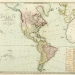
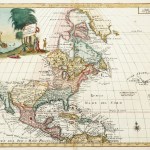
Amérique Septentrionale
$A 325 Add to cart
Showing 49–96 of 444 results