


Showing 97–144 of 445 results
-

1774
Plan de la Baye du Bon Succes dans le Detroit de le Maire. Carte de la partie S.E. de la Terre de Feu comprenant le Deetroit de le Maire, et une partie de la Terre des Etats / par le Lieut. J. Cook 1769
$A 195 Add to cart -

1774
Carte de Maidenland ou de la Virginie de Hawkins, Decouverte par Sir Richard Hawkins en 1574 et du Canal Falkland ainsi appelle par le Capne. Jean Strong qui le traversa en 1689, fur le Farewell Vaisseau de Londres.
$A 245 Add to cart -

1774
Cours Du Mississipi et La Louisiane
$A 325 Add to cart -

1774
Vue du Côte N.O. de Masafuero.
$A 50 Add to cart -

1774
Les Terres Magellaniques
$A 95 Add to cart -

1774
L’Isle De La Martinique.
$A 145 Add to cart -

1774
Cap Providence avec la Baye et les mouillages qu’on trouve au N.N.E. de ce Cap. Anse St. David. Baye de L’Isle. Baye Puzling. Baye du Cap Upright. Baye Dauphin.
$A 75 Add to cart -

1774
Port Famine. Baye de Wood. Port Gallant et Baye Fortescue. Baye et Havre de Cordes.
$A 75 Add to cart -

1774
Partie Medidionale De Perou
$A 75 Add to cart -

1774
L’Isle St. Dominque
$A 175 Add to cart -

1774
Côte depuis la Baye d’York a la Baye et au Havre des Trois Isles
$A 75 Add to cart -

1774
Partie Septentrionaledu Perou.
$A 75 Add to cart -

1774
Les Isles Antilles
$A 175 Add to cart -

1778
South America, as Divided amongst the Spaniards and the Portuguese, the French and the Dutch. By Samuel Dunn, Mathematician.
$A 325 Add to cart -

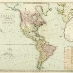
1778
America North and South: with the Atlantic and Pacific Oceans; wherein are distinguished, all the New Discoveries. By Samuel Dunn, Mathematician.
$A 575 Add to cart -

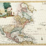
1778
A Map of the British Empire, in North America. By Samuel Dunn, Mathematician.
$A 1,475 Add to cart -

1782
Carte du Paraguay et parties des Pays adjacants. Projettee et assujiettie aux observations Astronomiques per M.Bonne…1782
$A 110 Add to cart -

1783
Partie de L’Amerique Septentrionale qui comprend le Canada, la Louisiane ….
$A 575 Add to cart -

1783
The coast of Guyana from the Oroonoko to the River of Amazons and inland parts as far as they have been explored by the French & Dutch engineers, with the islands of Barbadoes, Tobago &ca. From the observations of Captain Edward Thompson, made in the Hyaena, in the year 1781, when he commanded in the rivers Berbice, Essequebo and Demerari, and governed those colonies after their conquest from the Dutch.
$A 395 Add to cart -

1784
Chart of Norton Sound and of Bherings Strait made by the East Cape of Asia and the West Point of America.
$A 245 Add to cart -

1784
Sketch of Nootka Sound. A ship cove Lat. 49* 36’N. Long. 233* 18’E. var. 17* 49’E
$A 275 Add to cart -

1784
Chart of the NW Coast of America and NE Coast of Asia explored in the years 1778 & 1779. The unshaded parts of the Coast Asia are taken from a MS Chart received from the Russians.
$A 1,750 Add to cart -

1784
Chart of Cooks River in the N.W. part of America.
$A 275 Add to cart -

1784
Sketch of the Harbour of Samganooda on the Island of Oonalaska Lat. 53* 55’N, Long. 193* 30’E, Variation 20* 3′ E 1778
$A 75 Add to cart -

1785
Carte De L’Entree de Norton, et du Detroit de Bhering ou l’on voit le Cap le plus Oriental de L’Asie, et la Pointe la plus Occidental de L’Amerique.
$A 165 Add to cart -

1785
Plan du Havre de Samganoodha dans L’Isle de Oonalaska.
$A 65 Add to cart -

1785
Plan de l’Entree de Nootka.
$A 90 Add to cart -

1786
Guayane, Terre Ferme, Isles Antilles, Et Nlle Espagne.
$A 145 Add to cart -

1786
Hemisphere Occidental.
$A 325 Add to cart -

1786
L’Amerique
$A 325 Add to cart -

1786
Nouveau Mexique, Louisiane, Canada, et les Etats Unis
$A 475 Add to cart -

1787
Plan de la Situation et des Stations des Vaisseaux Britanniques, sous le Commandement de Sir Pierre Parker, a l’attaque du Fort Moultrie, Dans L’Isle Sullivan, le 28. Juin 1776.
$A 585 Add to cart -

1788
L’Ancien et le Nouveau Mexique, avec la Floride et la Basse Louisiane.
$A 225 Add to cart -

1788
Nouvea Royaume de Grenade, Nouvelle Andalousie et Guyane.
$A 65 Add to cart -

1788
L’Ancien et le Nouveau Mexique, avec la Floride et la Basse Louisiane. Partie Orientale.
$A 300 Add to cart -

1788
Isle de la Martinque. Isles de la Guadeloupe, de Marie Galante, de la desirade, et celles des Saintes.
$A 110 Add to cart -

1788
Les Etats Unis de L’Amerique Septentrionale, Partie Occidentale.
$A 325 Add to cart -

1788
Bresil et Pays des Amazones.
$A 110 Add to cart -

1788
Carte de la Cote N.O. de L’Amerique et de la Cote N.E. de L’Asie reconnes en 1778 et 1779.
$A 155 Add to cart -

1788
Detroit de Magellan, avec les Plans des principaux Ports, Bayes &c de ce Detroit.
$A 90 Add to cart -

1788
Carte de la Riviere de Cook, dans la partie N.O. de L’Amerique.
$A 155 Add to cart -

1788
Carte de L’Entree de Norton et du Detroit de Bhering, ou l’on voit le Cap le plus Oriental de L’Asie, et la pointe la plus Occidentale de L’Amerique.
$A 145 Add to cart -

1790
A chart of the Northern Pacific Ocean containing the NE coast of Asia and NW coast of America explored in 1778 and 1779 by Captain Cook and farther explored in 1788 and 1789 by John Meares.
$A 750 Add to cart -

1796
The United States of North America: with the British Territories and those of Spain, according to the Treaty, of 1784 Engraved by Wm. Faden 1796.
$A 8,500 Add to cart -

1798
Chart of the North West Coast of America Explored by the Boussole & Astrolabe in 1786. 1st. Sheet.
$A 295 Add to cart -

1798
Plan of the Entrance of the Port of Bucarelli on the North West Coast of America,…..
$A 450 Add to cart -

1798
Plan of the Bay of Conception in Chili.
$A 125 Add to cart -

1798
Chart of Part of the North West Coast of America Explored by the Boussole & Astrolabe laid down conformably to the situation of the Boussole every day at noon as determined Astronomically.
$A 295 Add to cart
Showing 97–144 of 445 results