


Showing 145–192 of 444 results
-

1798
An Accurate Map of the West Indies from the Latest Improvements
$A 110 Add to cart -

1798
Chart of the North West Coast of America Explored by the Boussole & Astrolabe in 1786. 2nd. Sheet.
$A 295 Add to cart -
 United States")
1798
Plan of Port des Francais on the North West Coast of America… Discovered July 1786 by the Boussole & Astrolabe. (Lituya Bay, Alaska)
$A 550 Add to cart -

1800
British America, Comprehending Canada, Labrador, New-Foundland, Nova Scotia & c:
$A 450 Add to cart -

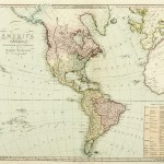
1800
South America.
$A 395 Add to cart -

1801
Vues de Diverses Parties de la Cote Nord-Ouest D’Amerique.
$A 575 Add to cart -

1801
Vues des Iles Sandwich et Autres Iles.
$A 1,250 Add to cart -

1804
Possessions Anglaises en Amerique.
$A 90 Add to cart -

1804
Possessions Espagnoles dans L’Amerique Septent.
$A 195 Add to cart -

1804
Indes Occientales.
$A 75 Add to cart -

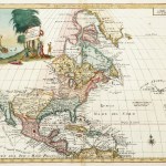
1808
North America
$A 375 Add to cart -

1809
British Possessions in North America.
$A 495 Add to cart -

1815
North America from the Best Authorities.
$A 110 Add to cart -

1815
South America from the Best Authorities.
$A 110 Add to cart -

1815
West Indies from the Best Authorities.
$A 110 Add to cart -

1817
Jamaica
$A 250 Add to cart -

1817
Chart of the Bahama Islands, The Bermudas or Summer Islands, Island of Cuba.
$A 475 Add to cart -

1817
West Indies.
$A 495 Add to cart -

1817
West India Islands. Grenada. Tobago. Trinidad. Curacao.
$A 245 Add to cart -
")
1818
North America. From the best Authorities.
$A 195 Add to cart -
")
1818
British Colonies in North America. From the best Authorities.
$A 165 Add to cart -

1818
States of America. From the best Authorities.
$A 165 Add to cart -

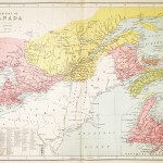
1823
Canada
$A 110 Add to cart -
")
1823
North America.
$A 65 Add to cart -

1823
South America.
$A 75 Add to cart -

1823
West Indies
$A 65 Add to cart -

1824
Chart of the Bay of Fundy, Compiled from Various Manuscript Documents in the Hydrographical Office of the Admiralty. 1824 Sheet 2nd.
$A 1,350 Add to cart -

1824
Carte De La Province De Rio De Janeiro.
$A 475 Add to cart -

1825
Plan de la Baie de Rio de Janeiro d’apres un manuserit Portugaise de Manoel Vieira Leao.
$A 650 Add to cart -

1832
North America Sheet II Lower – Canada and New Brunswick with part of New York and Maine.
$A 110 Add to cart -

1832
North America, Novia Scotia with part of New Brunswick and East Canada
$A 75 Add to cart -

1832
La Plata, Chili and the Banda Orientale
$A 50 Add to cart -

1832
West Indies
$A 45 Add to cart -

1832
Brazil, by J. Arrowsmith.
$A 475 Add to cart -

1832
Brazil with Guiana & Paraguay
$A 65 Add to cart -

1832
Mexico.
$A 1,850 Add to cart -

1833
North America Sheet X Parts of Missouri, Illinois, Kentucky, Tennessee, Alabama, Mississippi and Arkansas.
$A 125 Add to cart -

1833
North America Sheet XI parts of North and South Carolina
$A 145 Add to cart -

1833
North America Sheet IX Parts of Missouri, Illinois and Indiana.
$A 125 Add to cart -

1833
North America Sheet VII Pennsylvania, New Jersey, Maryland, Delaware, Columbia and part of Virginia.
$A 165 Add to cart -

1833
North America Sheet V The North West and Michigan Territories.
$A 145 Add to cart -

1833
North America Sheet IV Lake Superior
$A 135 Add to cart -

1833
Carte de L’Ile de la Trinite / Carte des iles Salvages / Carte du en Partie des Iles May et San-Yago
$A 275 Add to cart -

1834
Peru & Bolivia, by J. Arrowsmith.
$A 375 Add to cart -

1834
North America Index Map to Canada and the United States
$A 175 Add to cart -

1834
North America XIV Florida
$A 425 Add to cart -

1834
United States, by J. Arrowsmith.
$A 950 Add to cart -

1834
South America by J. Arrowsmith.
$A 850 Add to cart
Showing 145–192 of 444 results