


Showing 97–131 of 131 results
-
")
1877
Oceania by Keith Johnston, F.R.S.E.
$A 225 Add to cart -
![[ASIA-BURMA] Cocanada to Bassein River......](https://antiqueprintmaproom.com/wp-content/uploads/2022/04/MG_5646-copy-270x181.jpg "[ASIA-BURMA] Cocanada to Bassein River…… Southeast Asia")
1877
[ASIA-BURMA] Cocanada to Bassein River……
$A 450 Add to cart -

1880
Originalkarte des Mittleren Sumatra zur Ubersicht der Wissenschaftlichen Expedition 1877 bis 1879…
$A 195 Add to cart -
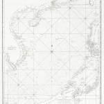
![[ASIA-BURMA] Bay of Bengal](https://antiqueprintmaproom.com/wp-content/uploads/2022/04/MG_5643-copy-270x185.jpg "[ASIA-BURMA] Bay of Bengal Asia (General)")
1880
[ASIA-BURMA] Bay of Bengal
$A 650 Add to cart -

1881
Reiseroute des Indischen Punditen A-a im Gebiet des Oberen Irawaddy 1879-80.
$A 65 Add to cart -
 from a survey by Mr. D. D. Daly. Malaysia")
1882
Map of the Northern Part of Perak (Malay Peninsula) from a survey by Mr. D. D. Daly.
$A 450 Add to cart -

1882
The Journey of Pundit Alaga, the Sources of the Irawadi River, and its supposed connection with the Sanpo River. a.Sandeman…..
$A 245 Add to cart -

1883
Map of South-Eastern Asia and Northern Australia showing The Districts in Annam and Tonquin which Frances proposes to annex and to place under the Protectorate, The portion of New Guinea proposed to be acquired by Queensland, And the Districts affected by
$A 425 Add to cart -

1885
Burmah Upper and Lower
$A 55 Add to cart -

1885
Sketch Map Showing the Probable Course of the San Po Tibet to the Irawadi of Burma According to Native Authorities….
$A 185 Add to cart -

1886
Map of Burmah and the Surrounding Countries by James Wyld.
Read more -

1888
Plan of the Ruby Mine Districts of Burma / Burma Showing the Position of the Ruby Mines.
$A 245 Add to cart -

1890
Farther India
$A 195 Add to cart -
![[ASIA-MALAYSIA] Malacca Strait Pulo Berhala to Cape Rachado](https://antiqueprintmaproom.com/wp-content/uploads/2023/11/MG_9675web-270x207.jpg "[ASIA-MALAYSIA] Malacca Strait Pulo Berhala to Cape Rachado Asia")
1895
[ASIA-MALAYSIA] Malacca Strait Pulo Berhala to Cape Rachado
$A 1,250 Add to cart -
![[ASIA-MALAYSIA] Malacca Strait with Part of the East Coast of the Malay Peninsula](https://antiqueprintmaproom.com/wp-content/uploads/2020/07/MG_0821-copy-270x184.jpg "[ASIA-MALAYSIA] Malacca Strait with Part of the East Coast of the Malay Peninsula Town Plans")
1898
[ASIA-MALAYSIA] Malacca Strait with Part of the East Coast of the Malay Peninsula
$A 2,250 Add to cart -

1898
Malaiischer Archipel.
$A 125 Add to cart -
![[ASIA-SINGAPORE] Straits of Durian Sugi and Chombol.](https://antiqueprintmaproom.com/wp-content/uploads/2020/06/mg_7612_copy-270x198.jpg "[ASIA-SINGAPORE] Straits of Durian Sugi and Chombol. Indonesia, East Indies")
1900
[ASIA-SINGAPORE] Straits of Durian Sugi and Chombol.
$A 1,350 Add to cart -

1901
Manila and Cavite Anchorages Manila Bay.
$A 425 Add to cart -

1902
Farther India. East Indian Archipelago.
$A 195 Add to cart -

1903
Philippine Islands and Hawaii.
$A 225 Add to cart -

1903
Philippine Islands and Hawaii.
$A 85 Add to cart -
![[ASIA-SINGAPORE] China Sea - Singapore Road](https://antiqueprintmaproom.com/wp-content/uploads/2020/07/MG_0747-copy-179x270.jpg "[ASIA-SINGAPORE] China Sea – Singapore Road Wall Maps")
1911
[ASIA-SINGAPORE] China Sea – Singapore Road
$A 6,750 Add to cart -
![[ASIA-SINGAPORE] China Sea Singapore Straight](https://antiqueprintmaproom.com/wp-content/uploads/2024/07/MG_8834-270x143.jpg "[ASIA-SINGAPORE] China Sea Singapore Straight ASIA")
1914
[ASIA-SINGAPORE] China Sea Singapore Straight
$A 4,750 Add to cart -

1917
Mer de Chine Golfe du Tonkin Baie D’Halong
$A 1,500 Add to cart -

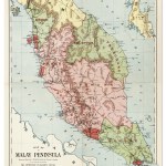
1923
Map of the Malay Peninsula
$A 650 Add to cart -

1923
Negri Sembilan
$A 325 Add to cart -

1925
Atlas-Geography of Siam / Atlas-Geographie du Siam
$A 750 Add to cart -

1931
Malaya 1931
$A 750 Add to cart -

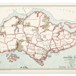
1936
Singapore 1935
$A 2,250 Add to cart -
![Borneo Including [Sarawak and Brunei]](https://antiqueprintmaproom.com/wp-content/uploads/2020/06/mg_7898_copy_1-187x270.jpg "Borneo Including [Sarawak and Brunei] Southeast Asia")
1943
Borneo Including [Sarawak and Brunei]
$A 475 Add to cart -
 MAPS & GLOBES")
1943
Celebes (Netherlands Indies)
$A 475 Add to cart -

1943
Philippine Is.
$A 525 Add to cart -

1948
Federation of Malaya, and Singapore
$A 1,250 Add to cart -

1950
Road Map of Malaya
$A 275 Add to cart -
")
2013
South Land The Search for Spices Maps 1513-1811
$A 25 Add to cart
Showing 97–131 of 131 results