
Showing 145–188 of 188 results
-
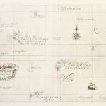
![[AUSTRALIA-] A General Chart of the Indian and Part of the Pacific Oceans, Shewing the Various Passages to & from China, Australia, New Zealand, &c. Carefully Constructed & Compiled from the most approved Observations and Modern Surveys, by J.S. Hobbs, F.R.G.S. Hydrog](https://antiqueprintmaproom.com/wp-content/uploads/2020/06/untitled-1_pano-270x150.jpg "[AUSTRALIA-] A General Chart of the Indian and Part of the Pacific Oceans, Shewing the Various Passages to & from China, Australia, New Zealand, &c. Carefully Constructed & Compiled from the most approved Observations and Modern Surveys, by J.S. Hobbs, F.R.G.S. Hydrog East Asia")
1873
[AUSTRALIA-] A General Chart of the Indian and Part of the Pacific Oceans, Shewing the Various Passages to & from China, Australia, New Zealand, &c. Carefully Constructed & Compiled from the most approved Observations and Modern Surveys, by J.S. Hobbs, F.R.G.S. Hydrog
$A 7,950 Add to cart -
")
1877
Oceania by Keith Johnston, F.R.S.E.
$A 225 Add to cart -
")
1877
Tiefen Karte des Grossen Oceans.
$A 195 Add to cart -

1879
New Guinea & Solomon Islands.
$A 115 Add to cart -
")
1882
The Pacific Ocean.
$A 165 Add to cart -
")
1886
Physikalische-Karte von Australien und Polynesien
$A 75 Add to cart -

1887
Jubilee and Philp Rivers and their Tributaries New Guinea
$A 165 Add to cart -

1887
Section of New Guinea.
$A 75 Add to cart -

1888
New Guinea.
On Hold Read more -

1888
Fiji Islands.
$A 225 Add to cart -
")
1888
Outline Map of Oceania Showing Routes of Early Discoverers.
$A 275 Add to cart -
![[Australia Sea Routes]](https://antiqueprintmaproom.com/wp-content/uploads/2020/06/mg_6985_copy_1-270x169.jpg "[Australia Sea Routes] Australia (General)")
1889
[Australia Sea Routes]
$A 110 Add to cart -

1890
Rough Sketch Plan of Hall Sound & Yule Island Showing Mouths of St.Joseph and Bioto Rivers.
$A 195 Add to cart -
")
1890
Oceania.
$A 145 Add to cart -
")
1893
Die Sudseeinseln.
$A 145 Add to cart -
")
1894
The Geography of Mammals / Map of the Australian Region showing its division into five Sub-Regions.
$A 65 Add to cart -
![[Telegraph Route]](https://antiqueprintmaproom.com/wp-content/uploads/2023/06/MG_8498-web-264x270.jpg "[Telegraph Route] Australia (General)")
1894
[Telegraph Route]
$A 475 Add to cart -

1895
Pacific Ocean
$A 90 Add to cart -
")
1895
Florenkarte von Australien und Ozeanien.
$A 110 Add to cart -
")
1895
Geologische Karte von Australien und Ozeanien.
$A 145 Add to cart -

1895
Karte des Deutschen Schutzgebietes in der Sudsee.
$A 90 Add to cart -

1895
Karte Der Entdeckungsreisen in Ozeanien.
$A 85 Add to cart -
")
1895
Politische Ubersichtskarte von Australien und Ozeanien.
$A 85 Add to cart -
")
1895
Ozeanien.
$A 155 Add to cart -
")
1895
Verbreitung der Tiere in Australien und Ozeanien.
$A 110 Add to cart -
")
1895
Verkehrskarte von Australien und Ozeanien.
$A 110 Add to cart -

1895
Polynesia
$A 90 Add to cart -
")
1895
Volkerkarte von Ozeanien und Australasien.
$A 125 Add to cart -
")
1898
Oceania
$A 195 Add to cart -
![[PACIFIC-NEW GUINEA] Plans of Anchorage on the North Coast of New Guinea.](https://antiqueprintmaproom.com/wp-content/uploads/2020/06/img_4779_copy-202x270.jpg "[PACIFIC-NEW GUINEA] Plans of Anchorage on the North Coast of New Guinea. Hydrographic")
1899
[PACIFIC-NEW GUINEA] Plans of Anchorage on the North Coast of New Guinea.
$A 375 Add to cart -
")
1902
Stiller Ocean.
$A 90 Add to cart -

1903
Philippine Islands and Hawaii.
$A 225 Add to cart -
")
1903
Pacific Ocean
$A 55 Add to cart -

1916
Trigonometrical Survey of Viti Levu Fiji.
$A 250 Add to cart -

1923
Nauru or Pleasant Island
$A 375 Add to cart -
, 1925 Pacific (General)")
1925
Dominion of New Zealand with its dependencies (and Western Samoa), 1925
$A 525 Add to cart -

1927
Map of Nauru or Pleasant Island
$A 375 Add to cart -
")
1940
Map of Pacific Ocean Mercators Projection.
$A 550 Add to cart -

1942
Pacific Ampol Map. Be in the van to smash Japan – buy 5/- national savings stamps.
$A 750 Add to cart -
![[Greater East Asia Co-Prosperity Sphere]](https://antiqueprintmaproom.com/wp-content/uploads/2020/06/mg_7469_copy_2-185x270.jpg "[Greater East Asia Co-Prosperity Sphere] Pacific (General)")
1942
[Greater East Asia Co-Prosperity Sphere]
$A 850 Add to cart -

1943
Philippine Is.
$A 525 Add to cart -
")
1943
Australia and New Guinea
$A 450 Add to cart -

1948
Fiji Islands 1948
$A 195 Add to cart -

1948
British Solomon Islands Protectorate
$A 145 Add to cart
Showing 145–188 of 188 results