The Voyages of Captain James Cook
Captain James Cook (1728–1779) stands among the most significant navigators of the Age of Enlightenment, whose three great Pacific voyages reshaped European understanding of the world’s oceans and continents. His careful seamanship, scientific precision, and detailed cartography left a lasting legacy that extended from the South Pacific to the Arctic.
The First Voyage (1768–1771)
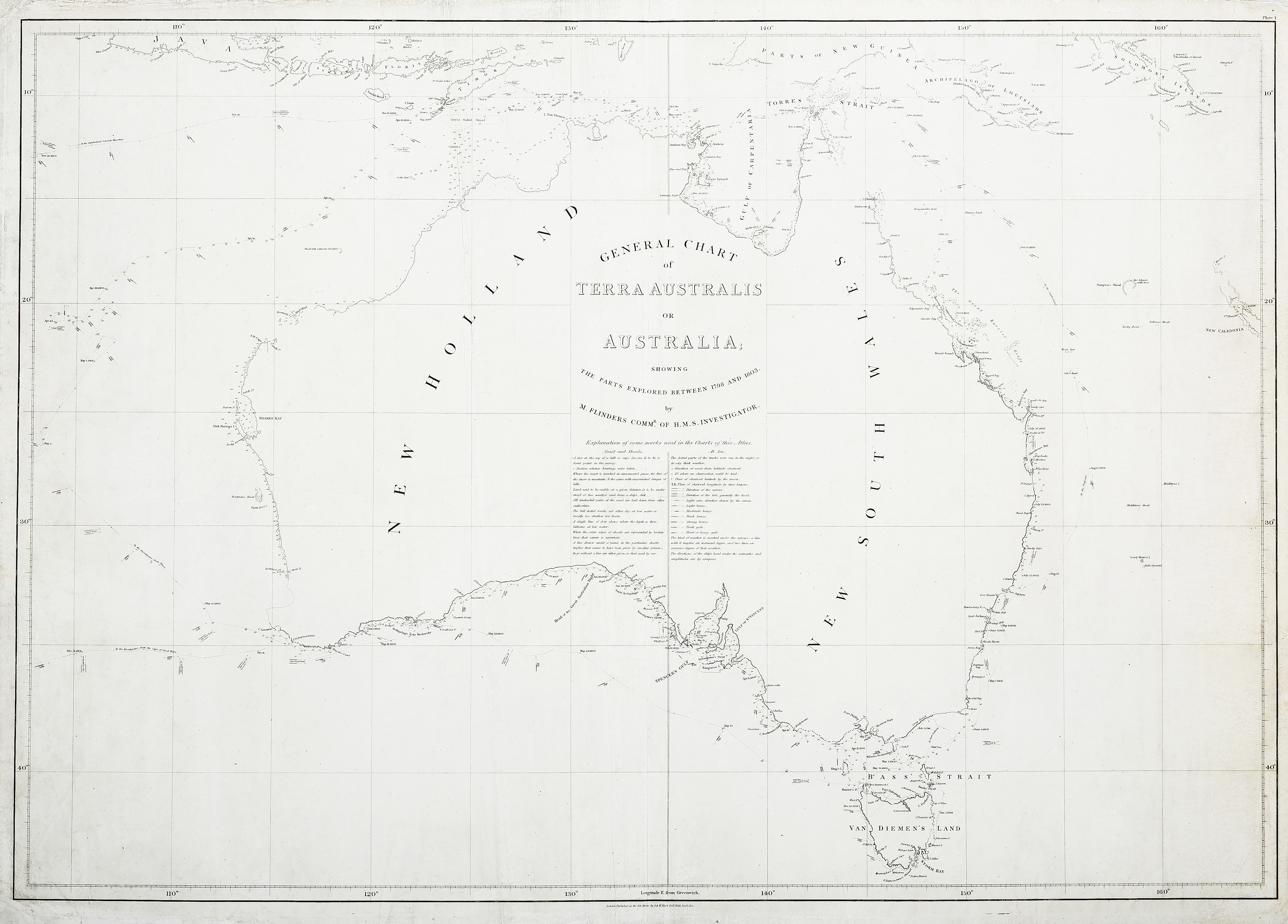
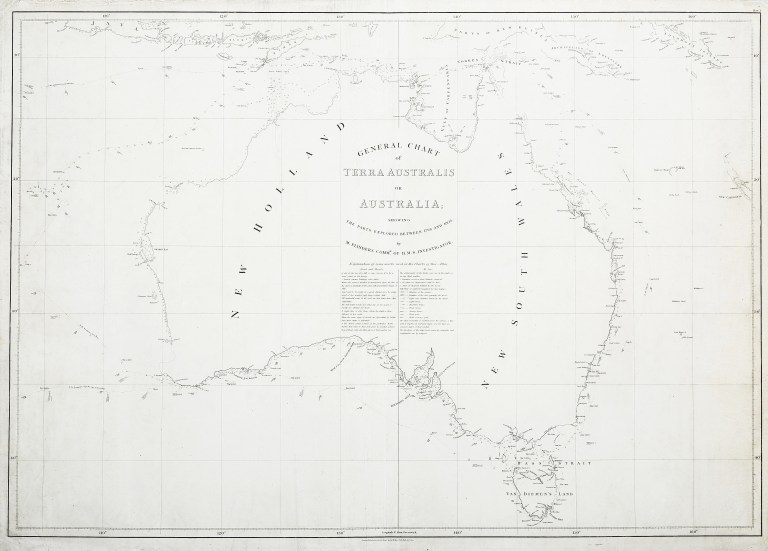
Cook’s first voyage, aboard HMS Endeavour, was commissioned by the Royal Society and the Admiralty. Its primary purpose was to observe the 1769 Transit of Venus from Tahiti, a rare astronomical event that promised to help determine the scale of the solar system. After the successful observation, Cook was ordered to search for the fabled “Great Southern Continent.” He proceeded to New Zealand, which he circumnavigated, proving it was not part of a larger landmass. He then sailed westward, charting the entire eastern coast of Australia with remarkable accuracy. On 22 August 1770, he claimed the territory for Britain under the name New South Wales. This first voyage established Cook’s reputation as a master cartographer and navigator.
The Second Voyage (1772–1775)
Cook’s second voyage, commanding HMS Resolution with HMS Adventure as consort, aimed to settle the question of the existence of Terra Australis Incognita, the vast southern continent long hypothesised by geographers. Sailing south, Cook crossed the Antarctic Circle in 1773, the first known navigator to do so. Although he did not sight Antarctica itself, his repeated southern forays demonstrated that no habitable continent existed in the temperate latitudes of the South Pacific. Along the way, he charted numerous Pacific islands, from Tonga to Easter Island, and improved European knowledge of Polynesian geography. The voyage further showcased Cook’s skill in maintaining the health of his crews, largely preventing scurvy through disciplined diet and hygiene.
The Third Voyage (1776–1779)
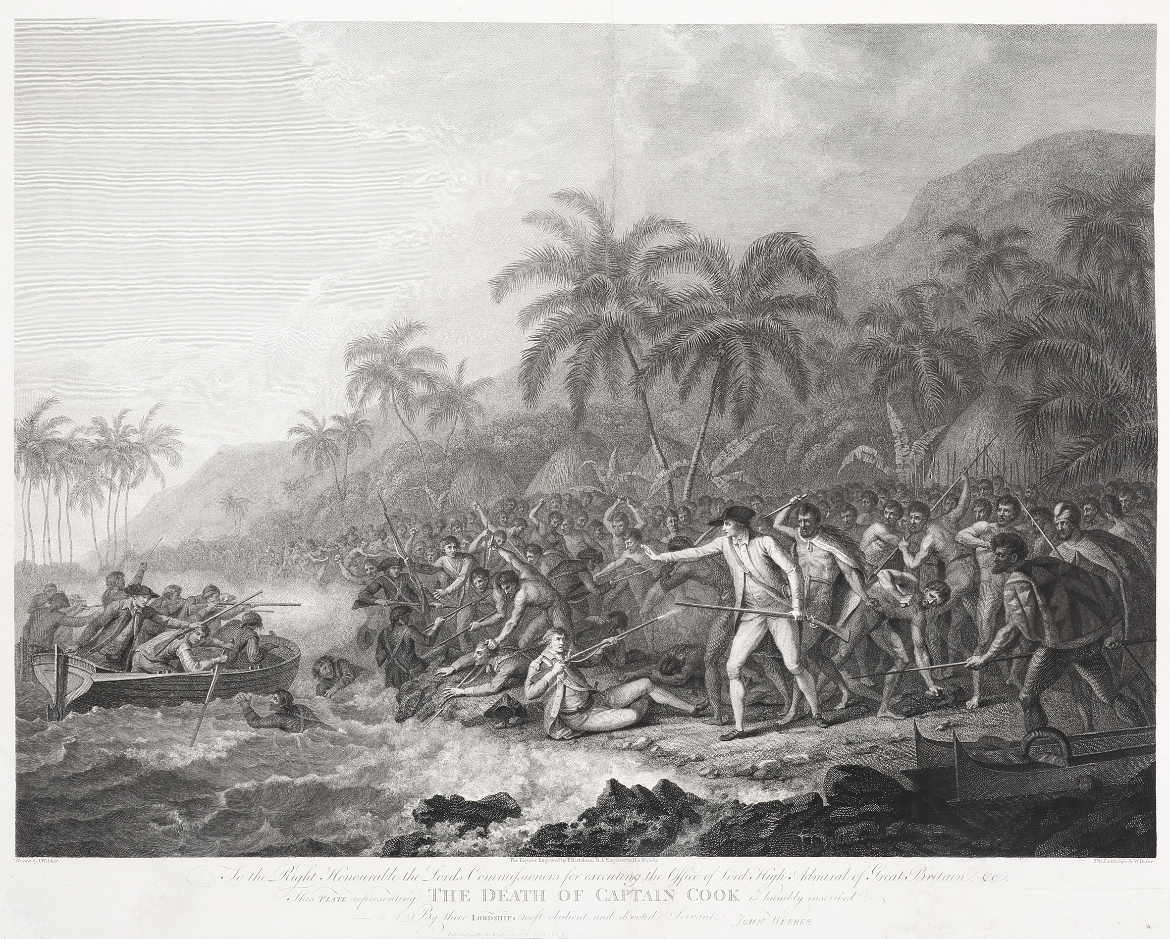
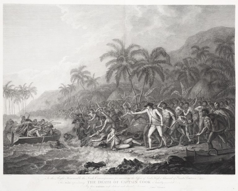
Cook’s final expedition sought a northwest passage between the Atlantic and Pacific. Again in Resolution, with HMS Discovery, he revisited many Polynesian islands before sailing north to the Pacific Northwest of America. He charted the coastlines of present-day British Columbia and Alaska with characteristic detail, before pressing into the Arctic. Ice ultimately forced him back. On the return journey, he visited the Hawaiian Islands, where he was initially welcomed. However, conflict arose during a later visit in 1779, and Cook was killed at Kealakekua Bay. His death marked the end of a career that had profoundly advanced geographic and scientific knowledge.
Legacy
Cook’s three voyages combined precise mapping, astronomical observation, and natural history. His charts of New Zealand, eastern Australia, and the Pacific remained authoritative for decades. He also demonstrated new standards in crew welfare and scientific cooperation, travelling with figures such as Joseph Banks and Johann Reinhold Forster. While his journeys facilitated imperial expansion, they also exemplified Enlightenment ideals of inquiry and documentation.
By the end of the 18th century, James Cook’s name had become synonymous with exploration, his voyages bridging the worlds of science, empire, and discovery, and reshaping Europe’s vision of the Pacific and beyond.