
Showing 97–144 of 189 results
-
![Oceanique. Archipel des Nlles. Hebrides. No.39. [Vanuatu]](https://antiqueprintmaproom.com/wp-content/uploads/2020/06/mg_3146_copy-270x233.jpg "Oceanique. Archipel des Nlles. Hebrides. No.39. [Vanuatu] Pacific (General)")
1827
Oceanique. Archipel des Nlles. Hebrides. No.39. [Vanuatu]
$A 225 Add to cart -

1827
Carte Generale de la Cote Septentrionale de la Nouvelle Guinee Reconnue
$A 275 Add to cart -

1827
Oceanique. Nouvelle Caledonie. No. 46.
$A 225 Add to cart -
![Oceanique. Iles Fidji. No. 040. [Fiji]](https://antiqueprintmaproom.com/wp-content/uploads/2020/06/mg_3145_copy-270x231.jpg "Oceanique. Iles Fidji. No. 040. [Fiji] Melanesia")
1827
Oceanique. Iles Fidji. No. 040. [Fiji]
$A 245 Add to cart -

1827
Oceanique. Partie des Iles Carolines. No. 8.
$A 200 Add to cart -
")
1827
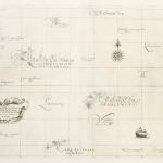
Carte Generale de L’Oceanie ou Cinquime Partie du Monde.
$A 325 Add to cart -

1827
Carte Generale de la Cote Septentrionale de la Nouvelle Guinee et de la Cote Meridionale de la Nouvelle Bretagne. Route de la Corvette L’Astrolabe us Tarvers des Carolines.
$A 325 Add to cart -

1827
Carte de la côte de la Nouvelle-Guinée, au sud de Doreri.
$A 275 Add to cart -

1827
Oceanique. Partie des Iles Carolines. No. 9.
$A 200 Add to cart -
")
1832
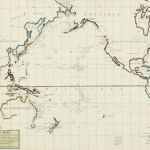
Pacific Ocean, by J. Arrowsmith.
$A 850 Add to cart -

1833
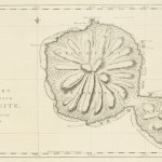
Plan de L’Ile Tonga-Tabou
$A 350 Add to cart -

1833
Carte de l’Archipel des Iles Viti
$A 450 Add to cart -
")
1834
Pacific Ocean, by J. Arrowsmith.
$A 750 Add to cart -

1834
Carte des Iles Taiti pour servir au Voyage pittoresque autour du Monde, par M.D’Urville, 1834.
$A 165 Add to cart -

1834
Carte des Iles Tonga : pour servir au voyage pittoresque autour du monde.
$A 125 Add to cart -
")
1835
Polynesia
$A 45 Add to cart -
")
1835
Pacific Ocean
$A 155 Add to cart -
")
1836
Oceanie
$A 525 Add to cart -
")
1836
Oceanie Dressee par C.V. Monin
$A 650 Add to cart -
")
1836
Oceania Sulla Projezionee de Mercatore.
$A 275 Add to cart -
")
1837
Carte de la Malaisie ou Grand Archipel D’Asie 1836.
$A 225 Add to cart -
")
1837
Oceanie
$A 145 Add to cart -

1837
New South Wales and Van Dieman’s Land.
$A 650 Add to cart -
")
1838
Oceanie par C.V. Monin.
$A 325 Add to cart -

1839
Carte des Iles Hawaii…1834
$A 675 Add to cart -
")
1840
The Pacific Ocean.
$A 225 Add to cart -
")
1840
Pacific Ocean.
$A 195 Add to cart -
")
1841
Chart of the Pacific Ocean.
$A 275 Add to cart -
")
1843
Islands in the Pacific Ocean
$A 450 Add to cart -
")
1843
Oceanie
$A 165 Add to cart -
 Australia (General)")
1844
Untitled No. 3 (Western Pacific)
$A 195 Add to cart -
")
1846
Carte de la Cote Sud-Ouest de la Nouvelle Guinee ..
$A 325 Add to cart -
")
1847
Carte Geologique de L’Oceanie
$A 850 Add to cart -
")
1847
Carte des Diverses Especes de Recifs de L’Oceanie…….. Mr. le Dr Grange
$A 795 Add to cart -
")
1852
Islands in the Pacific Ocean
$A 350 Add to cart -

1852
Posesiones de Oceania. Islas Filipinas
$A 1,250 Add to cart -
![[PACIFIC_SOCIETY ISLANDS] Owaarre Harbour in Huaheine Island by Edwin Rowe Mast, R.N. 1852.](https://antiqueprintmaproom.com/wp-content/uploads/2024/12/MG_9361web-205x270.jpg "[PACIFIC_SOCIETY ISLANDS] Owaarre Harbour in Huaheine Island by Edwin Rowe Mast, R.N. 1852. Polynesia")
1853
[PACIFIC_SOCIETY ISLANDS] Owaarre Harbour in Huaheine Island by Edwin Rowe Mast, R.N. 1852.
$A 1,250 Add to cart -

1855
Oceania
$A 145 Add to cart -

1860
Oceania
$A 155 Add to cart -
")
1860
Map of Oceanica Exhibiting its Various Divisions Island Groups.
$A 225 Add to cart -
")
1860
Oceanie.
$A 650 Add to cart -
")
1862
West-Polynesien.
$A 245 Add to cart -
")
1862
Festland von Australien und benachbarte Inseln.
$A 395 Add to cart -
")
1862
Australien und Polynesien in Mercators Projection.
$A 325 Add to cart -
")
1862
Carte Physique et Politique de L’Oceanie.
$A 275 Add to cart -
![[PACIFIC-NEW CALEDONIA] Kunie or Isle of Pines to Wen Island.](https://antiqueprintmaproom.com/wp-content/uploads/2020/06/img_4813_copy_1-183x270.jpg "[PACIFIC-NEW CALEDONIA] Kunie or Isle of Pines to Wen Island. Melanesia")
1863
[PACIFIC-NEW CALEDONIA] Kunie or Isle of Pines to Wen Island.
$A 475 Add to cart -
")
1865
Oceanie
$A 195 Add to cart -
![[PACIFIC-NEW CALEDONIA] New Caledonia New Hebrides & Loyalty Islands.](https://antiqueprintmaproom.com/wp-content/uploads/2020/06/img_4819_copy_1-184x270.jpg "[PACIFIC-NEW CALEDONIA] New Caledonia New Hebrides & Loyalty Islands. Melanesia")
1866
[PACIFIC-NEW CALEDONIA] New Caledonia New Hebrides & Loyalty Islands.
$A 450 Add to cart
Showing 97–144 of 189 results