
Showing 1–96 of 118 results
-

1574
Tabula Asiae XII
$A 450 Add to cart -

1597
Tabula Asiae XII
$A 525 Add to cart -

1598
Deliniantur in hac tabula, Orae maritimae Abexiae, freti Mecani: al. Maris Rubri: Arabiae Freti Mecani: al Maris Rubri: Arabiae, Ormi, Persiae, Supra Sindam usque… / The description of the coast of Abex, the Straights of Meca, otherwise called the Red Sea..
$A 11,500 Add to cart -
")
1640
India Orientalis et Insulae Adiecentes.
$A 1,250 Add to cart -
![[Goa.]](https://antiqueprintmaproom.com/wp-content/uploads/2020/06/maps2-270x207.jpg "[Goa.] India")
1646
[Goa.]
$A 450 Add to cart -
")
1662
Tabula Indiae Orientalis.
$A 2,650 Add to cart -

1662
Tabula Indiae Orientalis.
$A 2,350 Add to cart -

1683
Presqv-Isle de L’Inde Decale Golfe de Bengala.
$A 245 Add to cart -
![Asia Corrected from the Observations communicated to the Royal Society at London and the Royal Academy at Paris. By John Senex F.R.S. To The Honorable Sr. George Markham. Baronet. This Map is Dedicated by his humble Obedient Serv[an]t John Senex.](https://antiqueprintmaproom.com/wp-content/uploads/2020/06/MG_9190-Web-270x188.jpg "Asia Corrected from the Observations communicated to the Royal Society at London and the Royal Academy at Paris. By John Senex F.R.S. To The Honorable Sr. George Markham. Baronet. This Map is Dedicated by his humble Obedient Serv[an]t John Senex. China")
1709
Asia Corrected from the Observations communicated to the Royal Society at London and the Royal Academy at Paris. By John Senex F.R.S. To The Honorable Sr. George Markham. Baronet. This Map is Dedicated by his humble Obedient Serv[an]t John Senex.
$A 2,450 Add to cart -

1727
Baay van Tricoen Male
$A 575 Add to cart -

1727
Nieuwe Kaart van Choromandel ende Malabar.
$A 650 Add to cart -

1727
Nieuwe Kaart van Het Eyland Ceylon
$A 850 Add to cart -

1730
Carte des Cotes Malabar et de Coromandel.
$A 525 Add to cart -

1733
Peninsula Indiae citra Gangem Hoc est Orae Celeberrimae Malabar & Coromandel Cum Adjacente Insula non minus celebratissima Ceylon…
$A 575 Add to cart -
")
1742
India Orientalis cum Adjacentibus Insulis Nova Delinineatione ob Oculos Posita.
$A 2,850 Add to cart -

1744
India as described by all Authors before the fifth Century.
$A 225 Add to cart -

1746
Plan de Madras et du Fort St Georges Pris par les Francoias le 21 September 1746.
$A 275 Add to cart -

1746
Baye Ville et Forts D’Andarajapour
$A 245 Add to cart -

1746
Nouvelle Carte du Royaume De Bengale.
$A 225 Add to cart -

1751
Premiere Partie de la Carte D’Asie Contenant la Turquie, L’Arabie, la Perse, L’Inde en Deca du Gange….
$A 1,450 Add to cart -

1752
Carte de L’Indoustan Suivant les Cartes les plus recentes, Conciliees avec les Relations et les Details …
$A 145 Add to cart -

1752
Carte de L’Inde Dressee pour La Compagnie des Indes
$A 975 Add to cart -

1753
Coromandel
$A 450 Add to cart -

1753
Carte de la Bayer Trinquemale.
$A 245 Add to cart -

1754
Theatre de la Guerre de Coromandel.
$A 225 Add to cart -

1760
The Countries of Indostan East of Delhi by Major James Rennell, late Surveyor General to the East-India Company in Bengal.
$A 325 Add to cart -

1763-1778
Plan for the Intelligence of the Military Operations at Calcutta, when attacked and taken by Seerajah Dowlet 1756.
$A 1,350 Add to cart -

1763-1778
A Map of the Country Extending Ten Miles to the West, and Eighteen to the East of Tritchinapoly.
$A 375 Add to cart -

1763-1778
Chittapet.
$A 295 Add to cart -
![Karical. [Karaikal]](https://antiqueprintmaproom.com/wp-content/uploads/2020/06/mg_0560_copy-217x270.jpg "Karical. [Karaikal] TOWN PLANS")
1763-1778
Karical. [Karaikal]
$A 145 Add to cart -

1763
Thiagur
$A 225 Add to cart -

1763-1778
Carangoly
$A 345 Add to cart -

1763-1778
Trinomalee.
$A 345 Add to cart -

1763-1778
Plan of the Fronts of Fort St. George attacked by Mr. Lally from the 14th of December 1758, to the 16th of February 1759, with part of the Black Town.
$A 750 Add to cart -

1763-1778
Permacoil.
$A 325 Add to cart -
![Chinglapet [Chengalpattu]](https://antiqueprintmaproom.com/wp-content/uploads/2020/06/mg_0558_copy-214x270.jpg "Chinglapet [Chengalpattu] TOWN PLANS")
1763-1778
Chinglapet [Chengalpattu]
$A 95 Add to cart -

1763-1778
Plan of the Attempt of the French Troops to take Tritchinapoly. by Escalade November 28 1753
$A 175 Add to cart -

1763-1778
Palam-Cotah, near Tinivelly.
$A 295 Add to cart -

1763-1778
Fort St. David with the French Attack May 1758
$A 275 Add to cart -

1764
Plan de Bombay et de ses Environs Tirc de Thornton Hyd, Ang.
$A 395 Add to cart -

1764
INDIA-Carte du District de Tranquebar.
$A 295 Add to cart -

1764
Plan de Pondicheri en 1741.
$A 225 Add to cart -

1764
Coste de Coromandel depuis Gondagamas jusqu’a Nurzapour.
$A 165 Add to cart -

1764
Plan de la ville de Mongher
$A 65 Add to cart -

1772
Chart of the northern part of the Bay of Bengal, laid down chiefly from the surveys made by Bartholomew Plaisted and John Ritchie
$A 550 Add to cart -

1774
Carte de la Tartarie Independante..
$A 225 Add to cart -

1774
Carte du Bengale avec la partie Septentrionale des etats de Roi D’Aua
$A 85 Add to cart -

1774
Indoustan ou Etats Du Mogol
$A 225 Add to cart -

1775
Carte des isles Nicobar
$A 375 Add to cart -
![[ASIA-CEYLON] Carte Plate qui Comprend L'Isle de Ceylan, et une Partie des Cotes de Malabar et de Coromandel.](https://antiqueprintmaproom.com/wp-content/uploads/2020/08/MG_1167-copy-270x179.jpg "[ASIA-CEYLON] Carte Plate qui Comprend L’Isle de Ceylan, et une Partie des Cotes de Malabar et de Coromandel. South Asia")
1775
[ASIA-CEYLON] Carte Plate qui Comprend L’Isle de Ceylan, et une Partie des Cotes de Malabar et de Coromandel.
$A 875 Add to cart -

1775
Carte Reduite de l’Ocean Oriental Septentrional, qui Contient une partie des Cotes d’Afrique, de l’Arabie, de la Perse, et celles de l’Indostan
$A 1,250 Add to cart -

1775
Carte Plate du Golf de Bengal depuis la Ligne Equinoctiale jusqu’a l’Embouchure du Grange.
$A 875 Add to cart -
![[ASIA-INDIA] Carte Reduite du Golfe de Bengale, depuis L'Isle de Ceylan Justquau Golfe de Siam, avec la Partie Septentroinale du Detroit de Malac.](https://antiqueprintmaproom.com/wp-content/uploads/2020/08/MG_2786-copy-270x201.jpg "[ASIA-INDIA] Carte Reduite du Golfe de Bengale, depuis L’Isle de Ceylan Justquau Golfe de Siam, avec la Partie Septentroinale du Detroit de Malac. South Asia")
1775
[ASIA-INDIA] Carte Reduite du Golfe de Bengale, depuis L’Isle de Ceylan Justquau Golfe de Siam, avec la Partie Septentroinale du Detroit de Malac.
$A 875 Add to cart -
![[ASIA-CEYLON] Carte Plate qui Comprend L'Isle de Ceylan, et une Partie des Cotes de Malabar et de Coromandel.](https://antiqueprintmaproom.com/wp-content/uploads/2021/03/MG_2784-copy-270x197.jpg "[ASIA-CEYLON] Carte Plate qui Comprend L’Isle de Ceylan, et une Partie des Cotes de Malabar et de Coromandel. South Asia")
1775
[ASIA-CEYLON] Carte Plate qui Comprend L’Isle de Ceylan, et une Partie des Cotes de Malabar et de Coromandel.
$A 650 Add to cart -

1775
Carte de la Baye et du Port of Trinquemalay dans l’Isle of Ceylan …..
$A 750 Add to cart -
![[ASIA] Carte Reduite de l'Ocean Oriental Septentrional, qui Contient une partie des Cotes d'Afrique, de l'Arabie, de la Perse, et celles de l'Indostan....](https://antiqueprintmaproom.com/wp-content/uploads/2021/03/MG_2782-copy-270x198.jpg "[ASIA] Carte Reduite de l’Ocean Oriental Septentrional, qui Contient une partie des Cotes d’Afrique, de l’Arabie, de la Perse, et celles de l’Indostan…. South Asia")
1775
[ASIA] Carte Reduite de l’Ocean Oriental Septentrional, qui Contient une partie des Cotes d’Afrique, de l’Arabie, de la Perse, et celles de l’Indostan….
$A 450 Add to cart -

1778
A Map of Independent Tartary, Containing the Countries of the Kalmuks and Uzbeks, with the Tibet. By Samuel Dunn, Mathematician.
$A 325 Add to cart -

1778
Bengal with its Divisions, and the Adjacent Countries.
$A 285 Add to cart -

1780
Carte des Cotes de Malabar et de Coromandel, presentee au Roy. Par son tres humble, tres obeissant et tres fidele sujet, G. Delisle.
$A 525 Add to cart -

1786
A Map of Bengal, Bahar, Oude & Allahabad with part of Agra and Delhi Exhibiting the Courses of the Ganges from Hurdwar to the Sea by James Rennell, F.R.S.
$A 1,150 Add to cart -

1788
Imperia Antiqua Pars Orientalis.
$A 110 Add to cart -

1792
Partie de la Nouvelle Grande Carte des Indes Orientales
$A 1,450 Add to cart -
")
1792
Partie De La Nouvelle Grande Carte Des Indes Orientales, Contenant Les Terres Du Mogol, Surate,Malabar, Coromandel, Bengale, Aracan, Pegu, Siam, Camboje…
$A 725 Add to cart -

1794
A chart of the northern part of the Bay of Bengal between Point Palmiras and the Aracan Shore: from the surveys made by Bartholomew Plaisted and John Ritchie, surveyors to the Honble. the East India Company, compared with those of Captain George Farmer, Captain Augustus Savage, and Benjamin Lacam: as also with the nautical observations of Captain John Hicks: to the Right Honorable the Commissioners for the controul of the British Affairs in the East Indies this chart is most respectfully dedicated by their most obedient and most humble servant Benjamin Lacam sic
$A 1,850 Add to cart -

1797
Inde Partie Meridionale de la Presqu’isle en deca du Gange.
$A 85 Add to cart -

1800
A map of the peninsula of India from the 19th degree north latitude to Cape Comorin.
$A 795 Add to cart -

1800
Hindoostan.
$A 525 Add to cart -

1823
Hindoostan.
$A 75 Add to cart -

1827
Bejapoor
$A 195 Add to cart -

1831
India II Madras Presidency
$A 65 Add to cart -

1832
Burmah, Siam, and Cochin China, by J. Arrowsmith.
$A 1,450 Add to cart -

1832
Asiatic Archipelago, by J. Arrowsmith.
$A 1,250 Add to cart -

1832
India III Bombay Presidency
$A 65 Add to cart -

1832
India IV.
$A 65 Add to cart -

1832
India V
$A 65 Add to cart -

1832
India VII.
$A 65 Add to cart -

1833
India IX
$A 65 Add to cart -

1833
India VI
$A 65 Add to cart -

1834
Inde
$A 145 Add to cart -

1834
India, by J. Arrowsmith.
$A 750 Add to cart -

1834
India X
$A 65 Add to cart -

1834
Northern Asia from the Himalaya Mountains to the Arctic Ocean.
$A 245 Add to cart -

1837
Map of India Constructed with Great Care and Research from all the Latest Authorities and Intended more Particularly to Facilitate a Reference to the Civil and Military Stations. Dedicated to Sir James Rivett Carnac, Bart. Chairman of the Court of Directors of the Honble the East India Company Arranged under the Direction of Captain R.M. Grindlay, by James Wyld Geographer to the Queen 1837.
$A 4,750 Add to cart -

1842
Burmah, Siam, and Cochin China.
$A 1,150 Add to cart -

1842
Calcutta
$A 375 Add to cart -

1843
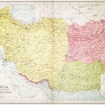
Persia and Cabool.
$A 325 Add to cart -

1844
India, Southern Part
$A 85 Add to cart -

1860
Southern Part. India with part of Afghanistan, Tibet, and the Adjacent Countries.
$A 145 Add to cart -

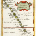
1866
Maldive Islands
$A 325 Add to cart -
![Map to illustrate Sir H. Bartle E. Frere's notes on the Runn of Cutch &c [Rann of Kutch]](https://antiqueprintmaproom.com/wp-content/uploads/2020/07/IMG_20200714_131437_-201x270.jpg "Map to illustrate Sir H. Bartle E. Frere’s notes on the Runn of Cutch &c [Rann of Kutch] South Asia")
1871
Map to illustrate Sir H. Bartle E. Frere’s notes on the Runn of Cutch &c [Rann of Kutch]
$A 125 Add to cart -

1871
Map of The Route From Badakshan Across The Pamir-Steppe to Kashgar With The Southern Branch Of The Upper Oxus from the Survey made by the Mirza in 1868-69 to accompany the Paper by Major T.G.Montgomerie R.E; F.R.G.S.
$A 145 Add to cart -

1876
Przewalski’s Reisen von Peking nach Tibet &… 1870-1873.
$A 125 Add to cart -
 by Keith Johnston, F.R.S.E. ASIA")
1877
India (Northern Sheet) by Keith Johnston, F.R.S.E.
$A 65 Add to cart -
![[ASIA-BURMA] Cocanada to Bassein River......](https://antiqueprintmaproom.com/wp-content/uploads/2022/04/MG_5646-copy-270x181.jpg "[ASIA-BURMA] Cocanada to Bassein River…… Southeast Asia")
1877
[ASIA-BURMA] Cocanada to Bassein River……
$A 450 Add to cart -

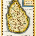
1877
Island of Ceylon
$A 90 Add to cart -
![[ASIA-BURMA] Bay of Bengal](https://antiqueprintmaproom.com/wp-content/uploads/2022/04/MG_5643-copy-270x185.jpg "[ASIA-BURMA] Bay of Bengal South Asia")
1880
[ASIA-BURMA] Bay of Bengal
$A 650 Add to cart
Showing 1–96 of 118 results
