


Showing 49–96 of 724 results
-

1764
Plan de Pondicheri en 1741.
$A 225 Add to cart -

1764
La Ville de Cayenne.
$A 185 Add to cart -

1764
Plan du Port D’Acapulco sur la Cote du Mexique dans la Mer du Sud.
$A 145 Add to cart -

1764
Gallia Antiqua ex Aevi Romani Monumentis eruta et Serenissimi Carnutum Ducis Munificentia Publicijuris Facta.
$A 375 Add to cart -

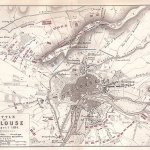
1766
Plan of Portobello
$A 145 Add to cart -

1774
Cosmography Epitomised, In Six Copper Plate Delineations.
$A 2,350 Add to cart -
")
1775
Carte Reduite de L’Ocean Oriental Depuis le Cap de Bonne Esperance, Jusqu’au Japon.
$A 3,250 Add to cart -
![[ASIA-CEYLON] Carte Plate qui Comprend L'Isle de Ceylan, et une Partie des Cotes de Malabar et de Coromandel.](https://antiqueprintmaproom.com/wp-content/uploads/2020/08/MG_1167-copy-270x179.jpg "[ASIA-CEYLON] Carte Plate qui Comprend L’Isle de Ceylan, et une Partie des Cotes de Malabar et de Coromandel. South Asia")
1775
[ASIA-CEYLON] Carte Plate qui Comprend L’Isle de Ceylan, et une Partie des Cotes de Malabar et de Coromandel.
$A 875 Add to cart -
![[ASIA-CEYLON] Carte Plate qui Comprend L'Isle de Ceylan, et une Partie des Cotes de Malabar et de Coromandel.](https://antiqueprintmaproom.com/wp-content/uploads/2021/03/MG_2784-copy-270x197.jpg "[ASIA-CEYLON] Carte Plate qui Comprend L’Isle de Ceylan, et une Partie des Cotes de Malabar et de Coromandel. South Asia")
1775
[ASIA-CEYLON] Carte Plate qui Comprend L’Isle de Ceylan, et une Partie des Cotes de Malabar et de Coromandel.
$A 650 Add to cart -
![[ASIA-INDONESIA] Carte de la Cote Occidentale de l'Isle Sumatra depuis la ligne Equinoctiale, jusquau Détroit de la Sonde.](https://antiqueprintmaproom.com/wp-content/uploads/2020/08/MG_2792-copy-203x270.jpg "[ASIA-INDONESIA] Carte de la Cote Occidentale de l’Isle Sumatra depuis la ligne Equinoctiale, jusquau Détroit de la Sonde. MAPS & GLOBES")
1775
[ASIA-INDONESIA] Carte de la Cote Occidentale de l’Isle Sumatra depuis la ligne Equinoctiale, jusquau Détroit de la Sonde.
$A 350 Add to cart -

1775
Carte de la Baye et du Port of Trinquemalay dans l’Isle of Ceylan …..
$A 750 Add to cart -
![[ASIA] Carte Reduite de l'Ocean Oriental Septentrional, qui Contient une partie des Cotes d'Afrique, de l'Arabie, de la Perse, et celles de l'Indostan....](https://antiqueprintmaproom.com/wp-content/uploads/2021/03/MG_2782-copy-270x198.jpg "[ASIA] Carte Reduite de l’Ocean Oriental Septentrional, qui Contient une partie des Cotes d’Afrique, de l’Arabie, de la Perse, et celles de l’Indostan…. South Asia")
1775
[ASIA] Carte Reduite de l’Ocean Oriental Septentrional, qui Contient une partie des Cotes d’Afrique, de l’Arabie, de la Perse, et celles de l’Indostan….
$A 450 Add to cart -
![[ASIA-INDONESIA] Carte de la Cote Occidentale de l'Isle Sumatra depuis la Riviere Sinkel Jusques a la Pointe D'Indrapour.](https://antiqueprintmaproom.com/wp-content/uploads/2020/08/MG_2794-copy-201x270.jpg "[ASIA-INDONESIA] Carte de la Cote Occidentale de l’Isle Sumatra depuis la Riviere Sinkel Jusques a la Pointe D’Indrapour. ASIA")
1775
[ASIA-INDONESIA] Carte de la Cote Occidentale de l’Isle Sumatra depuis la Riviere Sinkel Jusques a la Pointe D’Indrapour.
$A 350 Add to cart -
![[AFRICA] Plan de L'Isle de Bourbon, Situee sur l'Ocean Oriental.](https://antiqueprintmaproom.com/wp-content/uploads/2021/03/MG_2750-copy-189x270.jpg "[AFRICA] Plan de L’Isle de Bourbon, Situee sur l’Ocean Oriental. Africa Countries")
1775
[AFRICA] Plan de L’Isle de Bourbon, Situee sur l’Ocean Oriental.
$A 550 Add to cart -
![[ASIA-INDIA] Carte Reduite du Golfe de Bengale, depuis L'Isle de Ceylan Justquau Golfe de Siam, avec la Partie Septentroinale du Detroit de Malac.](https://antiqueprintmaproom.com/wp-content/uploads/2020/08/MG_2786-copy-270x201.jpg "[ASIA-INDIA] Carte Reduite du Golfe de Bengale, depuis L’Isle de Ceylan Justquau Golfe de Siam, avec la Partie Septentroinale du Detroit de Malac. South Asia")
1775
[ASIA-INDIA] Carte Reduite du Golfe de Bengale, depuis L’Isle de Ceylan Justquau Golfe de Siam, avec la Partie Septentroinale du Detroit de Malac.
$A 875 Add to cart -
![[AFRICA] Plan de L'Isle de France.](https://antiqueprintmaproom.com/wp-content/uploads/2021/05/MG_3339-copy-270x194.jpg "[AFRICA] Plan de L’Isle de France. Africa Countries")
1775
[AFRICA] Plan de L’Isle de France.
$A 2,250 Add to cart -

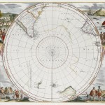
1776
Carte des deux Regions Polaires….
$A 750 Add to cart -

1786
Hemisphere Orientale
$A 750 Add to cart -

1786
Hemisphere Occidental.
$A 325 Add to cart -

1787
Plan de la Situation et des Stations des Vaisseaux Britanniques, sous le Commandement de Sir Pierre Parker, a l’attaque du Fort Moultrie, Dans L’Isle Sullivan, le 28. Juin 1776.
$A 585 Add to cart -

1791
Hémisphère Oriental ou Ancien Monde.
$A 225 Add to cart -

1793
The Newly Improved Armillary or Artificial Sphere.
$A 165 Add to cart -
![[London - Oxford Street]](https://antiqueprintmaproom.com/wp-content/uploads/2022/07/MG_6320-copy-245x270.jpg "[London – Oxford Street] Town Plans")
1794
[London – Oxford Street]
$A 2,250 Add to cart -
![[London - Buckingham Palace]](https://antiqueprintmaproom.com/wp-content/uploads/2022/07/MG_6321-copy-245x270.jpg "[London – Buckingham Palace] Town Plans")
1794
[London – Buckingham Palace]
$A 2,250 Add to cart -
![[London ]](https://antiqueprintmaproom.com/wp-content/uploads/2022/07/MG_6322-copy-1-244x270.jpg "[London ] Town Plans")
1794
[London ]
$A 950 Add to cart -
![[London - Marylebone]](https://antiqueprintmaproom.com/wp-content/uploads/2022/09/MG_6314-copy-243x270.jpg "[London – Marylebone] Town Plans")
1794
[London – Marylebone]
$A 1,750 Add to cart -
![[London - Paddington Parish]](https://antiqueprintmaproom.com/wp-content/uploads/2022/07/MG_6316-copy-249x270.jpg "[London – Paddington Parish] Town Plans")
1794
[London – Paddington Parish]
$A 1,750 Add to cart -
![[London Chelsea, Belgravia]](https://antiqueprintmaproom.com/wp-content/uploads/2022/07/MG_6318-copy-248x270.jpg "[London Chelsea, Belgravia] Town Plans")
1794
[London Chelsea, Belgravia]
$A 1,250 Add to cart -
![[London - Marylebone, Primrose Hill]](https://antiqueprintmaproom.com/wp-content/uploads/2022/07/MG_6319-copy-243x270.jpg "[London – Marylebone, Primrose Hill] Town Plans")
1794
[London – Marylebone, Primrose Hill]
$A 1,250 Add to cart -

1798
Plan of the Bay of Conception in Chili.
$A 125 Add to cart -

1800
Die untere oder sudliche Halbkugel der Erde auf den horizont von Wien stereographisch entworfen von J.A. Ecker, aufs neue ; verbessert herausgegeben von P.J. Schalbacher 1800
$A 1,450 Add to cart -
![[NEW ZEALAND] Bream Head to Tepaki Point (Mecury Bay) including Hauraki Gulf](https://antiqueprintmaproom.com/wp-content/uploads/2022/06/MG_5992-copy-270x180.jpg "[NEW ZEALAND] Bream Head to Tepaki Point (Mecury Bay) including Hauraki Gulf New Zealand")
1806
[NEW ZEALAND] Bream Head to Tepaki Point (Mecury Bay) including Hauraki Gulf
$A 650 Add to cart -

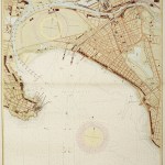
1807
Plan de la ville de Sydney Capitale des Colonies Anglaises, aux Terres Australes.
$A 1,150 Add to cart -
 Town Plans")
1809
PLAN DU QUARTIER DU PALAIS ROYAL.(2e Partie)
$A 165 Add to cart -
. Town Plans")
1809
Plan du Quartier Saint du Luxembourg. (2eme Partie).
$A 145 Add to cart -
 EUROPE")
1809
Plan du Quartier St. Antoine. (Deuxieme partie cote oriental)
$A 145 Add to cart -

1809
Plan du Quartier Montmartre
$A 195 Add to cart -

1809
Plan du Quartier St. Andre des Arcs.
$A 125 Add to cart -

1809
Plan du Quartier St. Benoit
$A 125 Add to cart -

1809
PLAN DU QUARTIER Sth OPPORTUNE.
$A 75 Add to cart -

1809
Plan du Quartier des Halles.
$A 75 Add to cart -

1809
Plan du Quartier Saint Denis.
$A 145 Add to cart -

1809
Plan du Quartier St. Jacques de la Boucherie
$A 75 Add to cart -

1809
Plan du Quartier de la Greve.
$A 75 Add to cart -

1809
Plan du Quartier du Temple ou du Marais.
$A 145 Add to cart -
 Town Plans")
1809
Plan du Quartier St. Antoine. (Premiere partie, cote occidental)
$A 125 Add to cart -

1809
Plan du Quartier Sainte Avoye
$A 90 Add to cart -

1809
Plan du Quartier Saint Martin.
$A 145 Add to cart
Showing 49–96 of 724 results